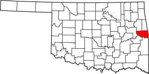
National Register of Historic Places listings in Sequoyah County, Oklahoma facts for kids
Have you ever wondered about the special places in your community that tell stories from the past? In Sequoyah County, Oklahoma, there are many such places! These are buildings, sites, or areas that are so important to history that they've been added to a special list called the National Register of Historic Places.
This list helps protect and celebrate amazing spots across the United States. When a place is on this list, it means it's recognized for its historical, architectural, or archaeological importance. It's like giving these places a special badge of honor! In Sequoyah County, there are 14 of these cool historic places. One of them is even a National Historic Landmark, which is an even higher honor! Let's explore some of these fascinating sites.
Contents
Exploring Sequoyah County's Historic Treasures
Sequoyah County is full of history, from ancient sites where people lived long ago to important buildings from more recent times. Each place on the National Register tells a unique part of the county's story.
Buildings with a Past
Many of the historic places in Sequoyah County are buildings that have stood for many years and seen a lot of change.
Citizen's State Bank
The Citizen's State Bank building in Marble City is a great example of early 20th-century architecture. Built in 1912, it served as an important financial center for the community. Imagine people coming here to deposit their money or get loans over a hundred years ago! It's located at Seminole and Main Streets.
Judge Franklin Faulkner House
In Sallisaw, you can find the Judge Franklin Faulkner House on East Cherokee Street. This house was built around 1903 and was home to Judge Franklin Faulkner, a very important person in the early days of Sallisaw. He was a judge and also involved in local businesses. Houses like this give us a peek into how people lived in the past.
First Presbyterian Church
Also in Sallisaw, the First Presbyterian Church on South Oak Street is another historic building. It was built in 1906 and has been a place of worship and community gathering for over a century. Its beautiful design shows the craftsmanship of the time.
Hines Round Barn
The Hines Round Barn in Sallisaw is a truly unique structure. Located at 401 South Adams Street, this barn was built in 1904. Round barns are quite rare and were often built for efficiency in farming. It's a cool reminder of the agricultural history of the area.
Old Sallisaw High School
The Old Sallisaw High School on West Creek Street was a central part of many students' lives for decades. Built in 1922, it served as the high school until a fire damaged it. Even though the main building was later taken down, it remains a significant part of Sallisaw's educational history.
Important Historical Sites
Beyond buildings, some places are important because of events that happened there or the people connected to them.
Dwight Mission
The Dwight Mission is located southwest of Marble City. This site is incredibly important because it was one of the earliest missions established in Oklahoma for the Cherokee people. It was founded in 1829 and played a big role in education and religious life for the Cherokee Nation. It's a place where you can learn about the history of Native Americans in the region.
Sequoyah's Cabin
One of the most famous and important sites in Sequoyah County is Sequoyah's Cabin. This cabin, located in Sequoyah's Cabin State Park near Akins, was the home of Sequoyah, a brilliant Cherokee scholar. He created the Cherokee syllabary, a writing system that allowed the Cherokee people to read and write in their own language. This was a huge achievement, and his cabin is recognized as a National Historic Landmark because of its connection to him. It's a must-see for anyone interested in American history!
Ancient Archaeological Sites
Some of the oldest and most mysterious places on the list are archaeological sites. These are places where scientists study the remains of ancient human activity, like tools, pottery, or old living areas. Because these sites are so delicate and important for understanding the past, their exact locations are often kept secret to protect them.
- Baker "A" Archeological Site (34SQ269)
- Ellison No. 2 Site (34SQ85)
- Fears Site (34SQ76)
- Kirby-Steely Archeological Site
- Lee's Creek Ceremonial Site
- Starr Pasture Archeological Site (34SQ224)
- Tall Cane Archeological Site (34SQ294)
These sites, mostly near Short or Nicut, give us clues about the people who lived in Sequoyah County thousands of years ago. They help us understand how early communities lived, hunted, and interacted with their environment.
Images for kids


