National Register of Historic Places listings in Shannon County, Missouri facts for kids
Have you ever wondered about the oldest and most special places in your community? In Shannon County, Missouri, there are many historic spots that are super important to the history of the United States. These places are so special that they are listed on the National Register of Historic Places. This is like a special club for buildings, areas, and even old campsites that tell us stories about the past.
These places help us learn about how people lived long ago. They show us what their homes looked like, where they worked, and even where ancient people might have gathered. In Shannon County, there are 16 different places and areas that have earned this special recognition. Let's explore some of them!
Discovering Shannon County's Historic Treasures
Shannon County is home to many amazing historic sites. Each one has a unique story to tell about the past. From old mills to ancient campsites, these places help us understand the rich history of the area.
Important Historic Sites
Here are some of the cool places in Shannon County that are on the National Register of Historic Places:
- Akers Ferry Archeological District: This is a special area near Rector that holds clues about ancient people. Archeological districts are places where scientists find old tools, pottery, and other items that tell us about how people lived thousands of years ago. Its exact location is kept secret to protect these important historical findings. It was added to the list in 1990.
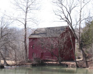
- Alley Spring Roller Mill: Located west of Eminence, this old mill is a fantastic example of early industry. Mills like this used to grind grain into flour. It was added to the list in 1981.
- Alton Club: This historic club is located near Eminence. It was added to the list in 2005.
- Buttin Rock School: This old school building is on the east bank of the Current River, south of Powder Mill Ferry. It reminds us of how kids used to learn many years ago. It became a historic site in 1991.
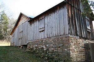
- Chilton-Williams Farm Complex: East of Eminence, this farm complex shows us what farming life was like in the past. It was added to the list in 1981.
- Culpepper-Pummil Site (23SH14/55): This is another archeological site near Alley Spring. Like other archeological sites, its exact location is kept private to protect the historical items found there. It was listed in 1988.
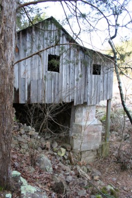
- Walter Klepzig Mill and Farm: This mill and farm are along Rocky Creek in the Ozark National Scenic Riverway. It's a great example of how people used the land and water for their daily lives. It was added to the list in 1990.
- Old Eminence Site (23SH104): This archeological site near Round Spring is another important place for understanding ancient history. Its location is restricted to protect it. It was listed in 1988.
- Owl's Bend Site (23SH10): This is an archeological site near Eminence. Its exact location is kept secret to protect the historical findings. It was added to the list in 1988.
- Pulltite Site (23SH94): This site near Eminence is another archeological treasure. Its location is restricted. It was listed in 1988.
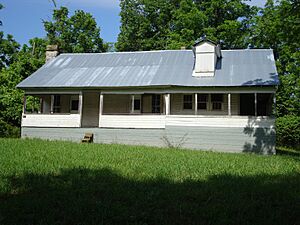
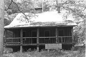
- Reed Log House: This log house is located along the Current River, south of Powder Mill Ferry. Log houses were common homes for early settlers. It was added to the list in 1991.
- Rhinehart Ranch: This ranch is northwest of Eminence. Ranches played a big part in the history of Missouri. It was listed in 1980.
- Round Spring Archeological District: This district is around the famous Round Spring. It's another area where archeologists can learn about the past. It was added to the list in 1993.
- Shawnee Creek Site: This archeological site near Eminence is another protected location. It was listed in 1990.
- Two Rivers Site: This is another important archeological site near Eminence. Its location is restricted to keep it safe. It was added to the list in 1993.
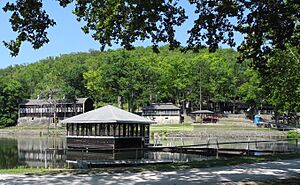
- Winona Ranger Station Historic District: Located near Winona, this district includes buildings used by forest rangers. These stations were important for managing forests and preventing fires. It was added to the list in 2003.
These historic places in Shannon County are like windows into the past. They help us understand the people, events, and ways of life that shaped the area into what it is today. Protecting them means we can keep learning from them for many years to come!


