
National Register of Historic Places listings in Sumter County, South Carolina facts for kids

This article is about the cool historic places in Sumter County, South Carolina, that are listed on the National Register of Historic Places. Think of it like a special list of important buildings, sites, and areas that are worth protecting because of their history.
These places are found all over South Carolina, United States. You can even see where some of them are on a map if their exact location is shared. In Sumter County, there are 29 places on this list. Three of these are extra special and are called National Historic Landmarks. This means they are super important to the history of the entire country!
Contents
- What is the National Register of Historic Places?
- Exploring Sumter County's Historic Gems
- Borough House Plantation: A Glimpse into the Past
- Holy Cross Episcopal Church: A Historic Place of Worship
- Millford Plantation: A Grand Old Home
- Carnegie Public Library: A Place for Learning
- Goodwill Parochial School: Education's History
- Mayesville Historic District: A Town's Story
- Pinewood Depot: A Stop on the Tracks
- Salem Black River Presbyterian Church: A Community Gathering Place
- Sumter County Courthouse: Where Decisions Were Made
- Sumter Town Hall-Opera House: Arts and Government Combined
- Temple Sinai: A Place of Faith
- Images for kids
What is the National Register of Historic Places?
The National Register of Historic Places is the official list of the nation's historic places. It's like a hall of fame for buildings, structures, objects, sites, and districts that are important in American history, architecture, archaeology, engineering, and culture. When a place is added to this list, it means it's recognized for its special value and efforts are made to preserve it.
Exploring Sumter County's Historic Gems
Let's take a look at some of the amazing places in Sumter County that have made it onto this important list. Each one tells a unique story about the past.
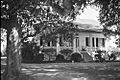
Borough House Plantation: A Glimpse into the Past
.jpg)
The Borough House Plantation is located in Stateburg, South Carolina. It's one of the three National Historic Landmarks in Sumter County. This means it's super important to the history of the whole country! The plantation was built a long time ago, and it shows us what life was like in the past. It's a great example of old Southern architecture.
Holy Cross Episcopal Church: A Historic Place of Worship

Also in Stateburg, South Carolina, you'll find the Holy Cross Episcopal Church. This church is another National Historic Landmark. It's known for its beautiful design and long history. Churches like this often served as important community centers in the past.
Millford Plantation: A Grand Old Home

Near Pinewood, South Carolina, stands Millford Plantation. This is the third National Historic Landmark in Sumter County. It's a very grand and impressive building. Plantations like Millford tell us a lot about the way people lived and worked in the past, and they are important for understanding history.
Carnegie Public Library: A Place for Learning

In Sumter, South Carolina, there's the Carnegie Public Library. This building is special because it was built with money from Andrew Carnegie, a famous businessman who helped build many libraries across the country. These libraries were important for helping people learn and get access to books.
Goodwill Parochial School: Education's History

The Goodwill Parochial School in Mayesville, South Carolina, is another historic site. Schools are vital parts of any community's history, showing how education has changed over time. This building reminds us of the efforts made to provide schooling in the past.
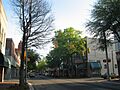
Mayesville Historic District: A Town's Story

The Mayesville Historic District in Mayesville, South Carolina, isn't just one building. It's a whole area! Historic districts are special because they show how a town or neighborhood developed over many years. Walking through this district is like taking a step back in time to see how Mayesville grew.
Pinewood Depot: A Stop on the Tracks

The Pinewood Depot is located in Pinewood, South Carolina. Train depots were once very busy places, where people traveled and goods were shipped. This depot reminds us of the importance of trains in connecting communities and helping them grow.
Salem Black River Presbyterian Church: A Community Gathering Place

East of Sumter, South Carolina, you'll find the Salem Black River Presbyterian Church. Churches often served as central points for communities, not just for worship but also for social gatherings and important events. This church has a long history in the area.
Sumter County Courthouse: Where Decisions Were Made

The Sumter County Courthouse in Sumter, South Carolina, is where many important decisions for the county have been made over the years. Courthouses are usually grand buildings that represent law and order, and they often have interesting architectural styles.
Sumter Town Hall-Opera House: Arts and Government Combined

Also in Sumter, South Carolina, is the Sumter Town Hall-Opera House. This building is unique because it served two purposes: as a town hall for local government and as an opera house for performances and entertainment. It shows how communities used to combine different functions in one important building.
Temple Sinai: A Place of Faith

Temple Sinai in Sumter, South Carolina, is a historic place of worship for the Jewish community. Buildings like this are important for understanding the diverse cultures and faiths that have shaped a community over time.
Images for kids
-
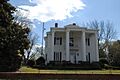
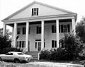
J. Clinton Brogdon House
-
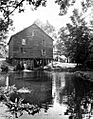
Ellerbe's Mill
-
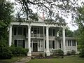
Heriot-Moise House
-
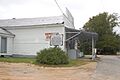
Lenoir Store
-
Magnolia Hall
-
Charles T. Mason House
-

Myrtle Moor
-
O'Donnell House
-
Orange Grove
-
Rip Raps Plantation
-
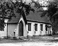
St. Mark's Church
-
Henry Lee Scarborough House
-
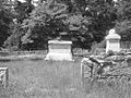
Singleton's Graveyard
-
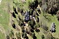
Sumter Historic District
-
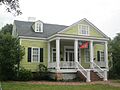
Elizabeth White House


