National Register of Historic Places listings in Williamsburg, Virginia facts for kids
This page lists special places in Williamsburg, Virginia, that are part of the National Register of Historic Places. Think of this register as a very important list kept by the United States government. It helps protect buildings, sites, and objects that are important to American history and culture.
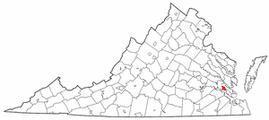
Williamsburg is a unique city in Virginia, known for its rich history. It's an "independent city," which means it's not part of a larger county. On this special list, Williamsburg has 15 different properties and areas. Six of these are even more important; they are called National Historic Landmarks. These landmarks are recognized as being exceptionally significant to the entire nation's history.
Contents
- What are Historic Places?
- Historic Sites in Williamsburg
- Bruton Parish Church
- Chandler Court and Pollard Park Historic District
- College Landing Archeological Site
- Merchants Square and Resort Historic District
- Peyton Randolph House
- James Semple House
- Matthew Whaley School
- Colonial Williamsburg Historic District
- Williamsburg Inn
- Wren Building, College of William and Mary
- Wythe House
- Images for kids
What are Historic Places?
The National Register of Historic Places is like a hall of fame for historical sites across the United States. When a place is added to this list, it means it's been carefully studied and found to be very important. This could be because of its history, its amazing architecture, or even because of important events that happened there. Being on the list helps protect these places for future generations to learn from and enjoy.
Why are Places Listed?
Places get listed for many reasons. Maybe a famous person lived there, or a major historical event took place. Sometimes, it's because the building itself is a great example of a certain style of architecture. For example, a very old church might be listed because it shows how buildings were made hundreds of years ago.
National Historic Landmarks
Among the places on the National Register, some are extra special. These are called National Historic Landmarks. They are recognized as being important to the history of the entire country, not just a state or city. Williamsburg is lucky to have several of these national treasures!
Historic Sites in Williamsburg
Williamsburg has many amazing places on the National Register. Let's explore some of them!
Bruton Parish Church
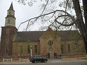
The Bruton Parish Church is a very old church located on Duke of Gloucester Street. It was built a long time ago, in 1715, and has been an important place for worship and community life ever since. Many famous people from early American history attended services here. It's a National Historic Landmark because of its long history and beautiful colonial architecture.
Chandler Court and Pollard Park Historic District
This area is a historic district, which means it's a neighborhood with many buildings that share a similar history or style. The Chandler Court and Pollard Park Historic District includes homes and streets that show how Williamsburg grew and developed over time. It's a great example of early 20th-century neighborhood planning.
College Landing Archeological Site
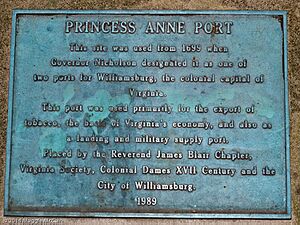
The College Landing Archeological Site is not a building, but a special area where archaeologists have found old artifacts. This site was Williamsburg's main port in the 1700s. Imagine ships arriving here, bringing goods and people! Finding old items like pottery or tools helps us understand what life was like back then.
Merchants Square and Resort Historic District
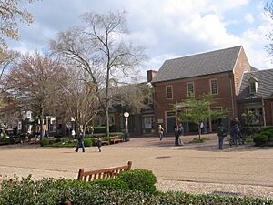
Merchants Square is a lively area with shops and restaurants right next to Colonial Williamsburg. It was one of the first planned shopping centers in the United States! This district also includes parts of the resort area, showing how tourism became important to Williamsburg. It blends modern life with historic charm.
Peyton Randolph House
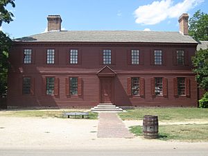
The Peyton Randolph House is a beautiful old home that belonged to Peyton Randolph. He was a very important person during the American Revolution. He served as the first president of the Continental Congress, which was a meeting of leaders from the American colonies. This house is a National Historic Landmark because of its connection to such a key figure in American independence.
James Semple House
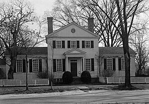
The James Semple House is another historic home in Williamsburg. It belonged to James Semple, who was a judge and a professor at the College of William & Mary. This house is a great example of the architecture from the late 1700s and early 1800s.
Matthew Whaley School
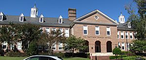
The Matthew Whaley School is a historic school building. It was built in the early 20th century and has been an important part of the community's education for many years. It shows how schools were designed and built during that time.
Colonial Williamsburg Historic District
Colonial Williamsburg is a very famous living history museum. It's a huge area that has been restored to look exactly like it did in the 1700s. You can walk around, see historic buildings, and even meet people dressed in colonial clothes who act like they live in that time! This entire district is a National Historic Landmark because it preserves such a large and important part of American colonial history.
Williamsburg Inn
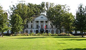
The Williamsburg Inn is a beautiful and historic hotel. It was built in the 1930s and designed to fit in with the colonial style of Williamsburg. It's known for its elegant design and for hosting many important guests over the years.
Wren Building, College of William and Mary
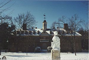
The Wren Building is the oldest college building in the United States that is still in use! It's part of the College of William & Mary, which is one of the oldest universities in the country. The building was designed by Sir Christopher Wren, a famous English architect. It's a National Historic Landmark because of its age, architecture, and importance to education in America.
Wythe House
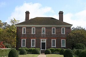
The Wythe House is another significant home in Williamsburg. It belonged to George Wythe, who was a very important lawyer and a signer of the Declaration of Independence. He also taught law to famous people like Thomas Jefferson. This house is a National Historic Landmark because of its strong connection to the founding of the United States.
Images for kids


