Nenzing facts for kids
Quick facts for kids
Nenzing
|
||
|---|---|---|
 |
||
|
||

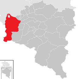
Location in the district
|
||
| Country | Austria | |
| State | Vorarlberg | |
| District | Bludenz | |
| Area | ||
| • Total | 110.35 km2 (42.61 sq mi) | |
| Elevation | 530 m (1,740 ft) | |
| Population
(2018-01-01)
|
||
| • Total | 6,239 | |
| • Density | 56.538/km2 (146.433/sq mi) | |
| Time zone | UTC+1 (CET) | |
| • Summer (DST) | UTC+2 (CEST) | |
| Postal code |
6710
|
|
| Website | http://www.nenzing.at | |
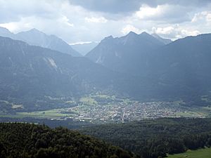
Nenzing is a charming market town located in the Bludenz area of Vorarlberg, a state in Austria. A market town is a special kind of town that traditionally held markets. In 2022, about 6,225 people lived here. Nenzing is known for its beautiful natural surroundings. It is a great place to live and visit.
Contents
Understanding Nenzing's Population Growth
The population of a town tells us how many people live there. Nenzing has seen its population grow steadily over many years. This growth shows that more and more people are choosing to make Nenzing their home.
How Nenzing's Population Has Changed Over Time
Looking at historical numbers helps us understand how Nenzing has developed. In 1869, there were less than 2,000 residents. By 1951, the population had grown to over 3,000. This increase continued into the 21st century.
The table below shows the population at different times:
| Historical population | ||
|---|---|---|
| Year | Pop. | ±% |
| 1869 | 1,975 | — |
| 1880 | 1,928 | −2.4% |
| 1890 | 1,982 | +2.8% |
| 1900 | 2,129 | +7.4% |
| 1910 | 2,252 | +5.8% |
| 1923 | 2,212 | −1.8% |
| 1934 | 2,521 | +14.0% |
| 1939 | 2,531 | +0.4% |
| 1951 | 3,478 | +37.4% |
| 1961 | 3,478 | +0.0% |
| 1971 | 4,412 | +26.9% |
| 1981 | 4,797 | +8.7% |
| 1991 | 5,140 | +7.2% |
| 2001 | 5,652 | +10.0% |
| 2011 | 5,991 | +6.0% |
| 2021 | 6,205 | +3.6% |
As you can see, the number of people living in Nenzing has more than tripled since 1869. This growth means the town has expanded and developed over the years.
Learning and Education in Nenzing
Nenzing offers good educational opportunities for its young residents. Education is very important for a town's future. It helps children grow and learn new skills.
Schools for All Ages
The town has several schools to support students from a young age through their early teens. There are five kindergartens for the youngest children. These kindergartens help prepare kids for primary school.
Nenzing also has four primary schools. In primary school, students learn important basics like reading, writing, and math. After primary school, students can attend the secondary modern school. This school helps students prepare for further education or a career.
Getting Around: Transport in Nenzing
Nenzing is well-connected by train, making it easy for people to travel. Good transport links are important for a town. They help people commute to work or visit other places.
Nenzing's Railway Connections
The Nenzing railway station is a key part of the town's transport system. It is located on a major train route that connects western and eastern Austria. This route is called the Vorarlberg railway line.
Trains from Nenzing can go towards Bregenz in the west or Bludenz in the east. From Bludenz, the Arlberg Railway line continues further east to Innsbruck and beyond. The train services are run by the Austrian Federal Railways (ÖBB). This includes regional trains called the Vorarlberg S-Bahn. These trains help people travel within the Vorarlberg region.
See also
 In Spanish: Nenzing para niños
 | Lonnie Johnson |
 | Granville Woods |
 | Lewis Howard Latimer |
 | James West |


