Neptune's Bellows facts for kids
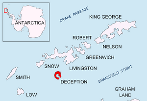
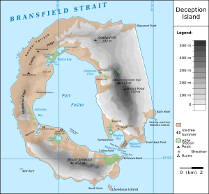
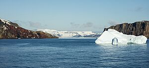
Neptune's Bellows is a narrow channel of water located in the South Shetland Islands. It is found on the southeast side of Deception Island. This channel acts as the main entrance to a large bay called Port Foster.
Contents
What is Neptune's Bellows?
Neptune's Bellows is a natural waterway. It is like a gateway to the inside of Deception Island. Deception Island is actually the top of an active volcano. Port Foster is the flooded caldera (crater) of this volcano. The channel is quite narrow, which makes it a special place for ships to enter the island's sheltered harbor.
Why is it Called Neptune's Bellows?
The name "Neptune's Bellows" was given by American sealers before the year 1822. They named it after Neptune, who was the Roman god of the sea. The channel got its name because of the very strong and sudden gusts of wind that blow through it. These winds can be so powerful that they seem to come from a giant trumpet or funnel, like a "bellows" used to blow air.
Where is Neptune's Bellows Located?
This channel is part of the South Shetland Islands. These islands are found off the coast of the Antarctic Peninsula. Deception Island is unique because it is a horseshoe-shaped island. Neptune's Bellows is the only way for larger ships to sail into the calm waters inside the island.
See also
- Deception Island
- Port Foster
- In Spanish: Fuelles de Neptuno para niños
 | Bayard Rustin |
 | Jeannette Carter |
 | Jeremiah A. Brown |


