
New Bedford River facts for kids
Quick facts for kids New Bedford River |
|
|---|---|

New Bedford River at Oxlode
|
|
| Specifications | |
| Status | Open |
| Navigation authority | Environment Agency |
| History | |
| Principal engineer | Cornelius Vermuyden |
| Date of act | 1649 |
| Date of first use | 1652 |
| Geography | |
| Start point | Earith |
| End point | Denver Sluice |
| Connects to | River Great Ouse |
The New Bedford River is a special man-made river in Cambridgeshire, England. People also call it the Hundred Foot Drain because the banks on either side are about 100 feet apart! This river helps control the water from the River Great Ouse in an area called the Fens. It's a very straight channel that runs between Earith and Denver Sluice. The river is tidal, meaning the water level changes with the ocean tides. You can even see the tide flow backwards at Welney, which is about 31 kilometres (19 miles) from the sea.
Contents
Building the New Bedford River
Why the River Was Needed
In the 1620s, the land where the New Bedford River is now often flooded. This made life very hard for the people living there. Francis Russell, 4th Earl of Bedford, who owned a lot of this land, decided to help. In 1630, he agreed to drain the area. In return, he would get about 38,445 hectares (95,000 acres) of the land that became dry.
Early Drainage Efforts
The Earl of Bedford teamed up with thirteen other people. They formed a group and got permission in 1634 to start the work. A Dutch engineer named Cornelius Vermuyden was put in charge. They dug nine big drainage channels, including the first Bedford River. This river went from Earith to Salter's Lode. The area they worked on became known as the Bedford Level. By 1637, they said the project was finished.
However, in 1638, King Charles I took over the project. He wanted to make sure the work was truly completed. The original group was given about 16,187 hectares (40,000 acres) for their efforts. Vermuyden was still the engineer, but not much more work was done. This was because the English Civil War started. During the war, the existing drainage systems were ignored and even damaged on purpose.
The New River Is Built
After the war, in 1649, people became interested in draining the Bedford Level again. A new law was passed to allow more work. This law let William Russell, the 5th Earl of Bedford, continue the project. The most important part of this new work was building a second channel. This channel was built right next to the first Bedford River.
Vermuyden was again the engineer for this big task. The new channel was finished in 1652. The first river became known as the Old Bedford River. The new channel was named the New Bedford River. Special gates called sluices were built at Earith and Denver. The New Bedford River then carried most of the water from the River Great Ouse. This meant the old path of the river through Ely became just a small drainage channel.
Managing the Rivers
The Corporation of the Bedford Level was created to manage the rivers and drainage channels. This happened under a law passed in 1663. However, this was not popular with boatmen who used the Great Ouse. The sluices were operated to help with drainage, which often meant boats had to wait for days or even weeks.
In 1713, the Denver Sluice was destroyed by very high floodwaters. The boatmen were happy about this, but it caused a lot of flooding. So, the Corporation built a new sluice between 1748 and 1750. To keep the boatmen happy, they added a navigation lock to the new structure. This lock allowed boats to pass through.

Workers Who Built the River
Some of the people who built the New Bedford River might have been Scottish prisoners of war. These prisoners were captured at the Battle of Dunbar. Many such prisoners were used for drainage projects in the Fens because there weren't enough workers. After 1652, Dutch prisoners also helped. They were captured during sea battles in the First Anglo-Dutch War. French workers living near Thorney Abbey also likely helped.
The River Delph Connection
Near the northern end of the washes, the River Delph joins the New Bedford River. This happens at Welmore Lake Sluice. This channel, sometimes called the thirty-foot drain, helps remove water from the washlands. Before 1825, there was a dam at the sluice's location. Water was let out by cutting a slot in the dam. This was expensive to rebuild each time. So, a proper sluice was built instead.
At the same time, the New Bedford River was made wider and deeper. Some of the flood banks were also raised. The River Delph connects to the Old Bedford River at its southern end. This connection is at a double bend near Welches Dam. The northern part of the Old Bedford River is no longer connected to its southern part.
The River's Path and Purpose

The New Bedford River is very straight. It flows northeast for about 33.5 kilometres (20.8 miles) from Earith to Denver Sluice. Boats can use the river, but there are some limits. Boats can't be deeper than about 0.6 metres (2 feet). Also, the space under bridges is limited to about 2.4 metres (7.8 feet). These measurements can change because the river is tidal.
Controlling the Water Flow
The area between the New and Old Bedford Rivers is called the Ouse Washes. This area is about 32 kilometres (20 miles) long. It's about 979 metres (1070 yards) wide at its widest point near Welney. This land is lower than the rivers and even below sea level. It often floods in winter.
A sluice at Earith helps control the water from the River Great Ouse. It was first built in 1637 with nine openings. It was rebuilt in 1824 with seven openings, and again in 1954 with three. When the river flow is normal, the sluice gates are closed. Most of the water then goes along the tidal New Bedford River.
When the river flow increases, the sluices are opened. Water then flows along the Old Bedford River. This causes the 23 square kilometres (8.9 square miles) of washlands to flood.
Wildlife and Nature Reserve
At Welney, these washlands are a perfect home for wildfowl (like ducks and geese) and other birds. The Wildfowl and Wetlands Trust has a nature reserve here called WWT Welney. The reserve covers about 400 hectares (990 acres). You can get there from the A1101 bridge. Just follow a small road to the parking lot, then cross the New Bedford River on a footbridge. The reserve is important for its wild flowers, dragonflies, and butterflies. The birds are most common when the washland is flooded.
Footpaths and Trails
There are public footpaths along both sides of the river for most of its length. Only a small part of the western bank near Earith doesn't have a path. A long-distance walking trail called the Hereward Way crosses the river at the A1101 bridge in Welney. It then follows the eastern bank south. It goes almost to the railway line that runs between March and Ely. Before reaching the railway bridge, the path turns east. It follows the north bank of the Engine Basin, which is a drainage channel. Water from this channel is pumped into the river by the Hundred Foot Pumping Station.
Images for kids
-
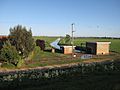
Oxlode pumping station on the banks of the New Bedford River

