New Hanover Township, Pennsylvania facts for kids
Quick facts for kids
New Hanover Township
|
|
|---|---|
|
Township
|
|

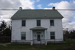
Long Meadow Farmhouse, a historic site in the township
|
|

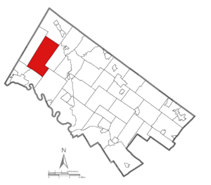
Location of New Hanover Township in Montgomery County
|
|

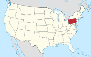
Location of PA in the United States
|
|
| Country | United States |
| State | Pennsylvania |
| County | Montgomery |
| Established | 1741 |
| Area | |
| • Total | 21.68 sq mi (56.2 km2) |
| • Land | 21.68 sq mi (56.2 km2) |
| • Water | 0.00 sq mi (0 km2) |
| Elevation | 427 ft (130 m) |
| Population
(2010)
|
|
| • Total | 10,939 |
| • Estimate
(2016)
|
12,776 |
| • Density | 504.57/sq mi (194.81/km2) |
| Time zone | UTC-5 (EST) |
| • Summer (DST) | UTC-4 (EDT) |
| Area codes | 610, 484 and 215, 267 and 445 |
New Hanover Township is a community located in Montgomery County, Pennsylvania, in the United States. In 2010, about 10,939 people lived here. It's a type of local government area called a township.
Contents
History of New Hanover Township
New Hanover Township was created in 1741. It used to be part of a larger area called Hanover Township.
Geography and Climate
New Hanover Township covers about 21.6 square miles (55.9 square kilometers) of land. It has many rolling hills and valleys. Water from the township flows into the Schuylkill River, mostly through the Perkiomen Creek.
Some of the small villages within New Hanover Township include Fagleysville, Frederick, Hoffmansville, Layfield, New Hanover, New Hanover Square, and Sassamansville.
The township has a hot-summer humid continental climate. This means it has warm, humid summers and cold winters. In Layfield, the average temperature in January is about 30.6°F (around -0.8°C). In July, the average temperature is about 75.3°F (around 24°C).
Neighboring Communities
New Hanover Township shares borders with several other communities:
- Upper Hanover Township (to the northeast)
- Upper Frederick Township (to the east)
- Limerick Township (to the southeast)
- Lower Pottsgrove Township (to the south)
- Upper Pottsgrove Township (to the southwest)
- Douglass Township (to the northwest)
Population and People
|
||||||||||||||||||||||||||||||||||||||||||||||||
In 2010, the township had a population of 10,939 people. Most residents, about 95.3%, were White. About 1.2% were Black or African American, and 2.0% were Asian. About 1.6% of the population had Hispanic or Latino family backgrounds.
In 2000, there were 7,369 people living in the township. About 40.1% of households had children under 18. The average household had 2.91 people. The median age of residents was 38 years old.
Local Government
New Hanover is a second-class township. This means it has a local government run by a group of five elected officials called supervisors. They are elected by all the voters in the township.
The current Board of Supervisors includes:
- Marie Livelsberger - Chair
- William Ross Snook - Vice Chair
- Kurt Zebrowski
- Boone Flint
- Keith Youse
Transportation and Roads
As of 2020, New Hanover Township had about 89.23 miles of public roads. The Pennsylvania Department of Transportation (PennDOT) maintains about 10.11 miles of these roads. The township itself takes care of the remaining 79.12 miles.
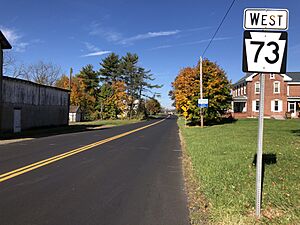
The main highways that go through New Hanover Township are Pennsylvania Route 73 and Pennsylvania Route 663. Route 73 runs east-west along Big Road. Route 663 runs northeast-southwest along North Charlotte Street and Layfield Road. These two routes also briefly share the same road near the center of the township.
For public transportation, the Pottstown Area Rapid Transit (PART) offers bus service. The Orange Line route serves the western part of the township and goes south to Pottstown.
See also
 In Spanish: Municipio de New Hanover (Pensilvania) para niños
 | DeHart Hubbard |
 | Wilma Rudolph |
 | Jesse Owens |
 | Jackie Joyner-Kersee |
 | Major Taylor |


