New Point, Indiana facts for kids
Quick facts for kids
New Point, Indiana
|
|
|---|---|
 |
|

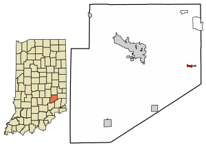
Location of New Point in Decatur County, Indiana.
|
|
| Country | United States |
| State | Indiana |
| County | Decatur |
| Township | Salt Creek |
| Area | |
| • Total | 0.31 sq mi (0.81 km2) |
| • Land | 0.31 sq mi (0.81 km2) |
| • Water | 0.00 sq mi (0.00 km2) |
| Elevation | 978 ft (298 m) |
| Population
(2020)
|
|
| • Total | 319 |
| • Density | 1,022.44/sq mi (394.67/km2) |
| Time zone | UTC-5 (Eastern (EST)) |
| • Summer (DST) | UTC-4 (EDT) |
| ZIP code |
47263
|
| Area code(s) | 812 |
| FIPS code | 18-53478 |
| GNIS feature ID | 2396807 |
| Website | http://www.newpointin.com |
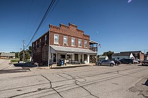
New Point is a small town in Indiana, United States. It is located in Decatur County, within Salt Creek Township. In 2020, about 319 people lived there.
Contents
A Look Back in Time
New Point was officially started in 1859. This is when the town was "laid out," meaning its streets and building lots were planned.
Where is New Point?
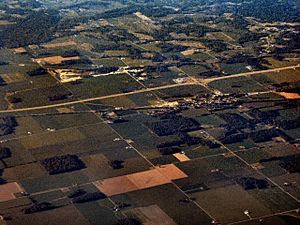
New Point is found in the state of Indiana. It is about half a mile south of a big highway called Interstate 74. Another road, State Highway 46, also runs nearby.
The town has its own water and sewage systems. However, it does not have natural gas piped directly to homes yet. The closest natural gas connection is about 5.5 miles away.
New Point covers a small area of land. It is about 0.81 square kilometers (or 0.31 square miles) in total.
A busy railway line runs through the town. This railway goes east to Cincinnati, Ohio and west to Indianapolis, Indiana. A tiny stream called Tub Creek also flows through New Point from north to south.
Who Lives in New Point?
| Historical population | |||
|---|---|---|---|
| Census | Pop. | %± | |
| 1880 | 174 | — | |
| 1900 | 451 | — | |
| 1910 | 341 | −24.4% | |
| 1920 | 317 | −7.0% | |
| 1930 | 342 | 7.9% | |
| 1940 | 328 | −4.1% | |
| 1950 | 322 | −1.8% | |
| 1960 | 319 | −0.9% | |
| 1970 | 381 | 19.4% | |
| 1980 | 296 | −22.3% | |
| 1990 | 296 | 0.0% | |
| 2000 | 290 | −2.0% | |
| 2010 | 331 | 14.1% | |
| 2020 | 319 | −3.6% | |
| U.S. Decennial Census | |||
Population in 2010
According to the census from 2010, there were 331 people living in New Point. These people lived in 124 households. About 84 of these households were families.
The town had about 1,504 people per square mile. There were 139 housing units in total. The average number of people in each household was 2.67. The average family size was 3.18 people.
The average age of people in the town was 36.6 years old. About 28% of the residents were under 18 years old. About 15% were 65 years old or older. Slightly more than half (51.4%) of the people were male, and 48.6% were female.
Fun Facts About New Point
New Point has a few important community places. It has a small post office where you can send mail. There is also a community center for local events. The town has a park for everyone to enjoy. A team of volunteers runs the fire department, keeping the town safe.
There are two churches in New Point. They are the New Point Christian Church and the New Point Baptist Church.
The town is managed by a group of elected officials. These officials make decisions for the community.
New Point hosts an annual festival called "Crackaway Daze." It happens on the third full weekend of September. There is also a yearly "Volunteer Fireman's Picnic." This event raises money for the fire department. It includes food, games, a dunk tank, and a raffle.
There used to be a school where the park is now. This school closed when smaller community schools joined together. They formed larger county school corporations. Now, the park is used for the Crackaway Daze festival. It is also used for other local events and for little league games.
See also
 In Spanish: New Point (Indiana) para niños


