Newlands, Wellington facts for kids
Quick facts for kids
Newlands
|
|
|---|---|
|
Suburb
|
|
| Country | New Zealand |
| Local authority | Wellington City |
| Electoral ward | Takapū/Northern Ward Wharangi/Onslow-Western Ward |
| Area | |
| • Land | 682 ha (1,685 acre) |
| Population
(June 2022)
|
|
| • Total | 8,170 |
| Postcode(s) |
6037
|
| Paparangi, Woodridge, Grenada | Horokiwi | |
| Johnsonville |
|
Wellington Harbour |
| Ngauranga |
Newlands is a suburb located in the northern part of Wellington, New Zealand. It's about 8 kilometers (5 miles) north of the city center. Newlands is next to Johnsonville on its west side.
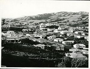
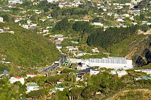
This area has a long history. It was once a large farm that helped supply milk to Wellington. Newlands is in a valley and also covers two hillsides. One of these hillsides offers views of Wellington Harbour and the Hutt Valley.
Contents
History of Newlands
The land where Newlands is today was first called Papararangi. This is a Te Reo Māori name that means "cluster of hills." In the 1840s, a large piece of land (about 40 hectares or 100 acres) was sold by the New Zealand Company.
There are two main ideas about how Newlands got its name. One idea is that it was named after Thomas Newland. He came to New Zealand in 1875. He ran a business in nearby Johnsonville and later worked for a meat company. Thomas Newland was friends with Walter Futter, who owned land in the area.
The second idea is simpler. People might have called it "New Land" because it was a new area being developed near Johnsonville.
For many years, from the 1920s to the 1950s, Newlands was mostly used for pig and dairy farming. These farms provided most of the milk for Wellington city. Farmers like Bill Miles and Ernest Hoskings had large dairy herds here. After World War II, some of the farm land was divided into smaller sections to build houses.
After World War I, a special memorial was built in Newlands. This memorial was later replaced after World War II because the road needed to be made wider.
People of Newlands (Demographics)
Newlands is made up of two main areas: Newlands North and Newlands South. Together, they cover about 6.82 square kilometers (2.63 square miles).
In 2018, about 7,824 people lived in Newlands. This was an increase of 549 people since 2013. The population has grown quite a bit over the years.
There were 2,739 homes in Newlands in 2018. The number of males and females was almost equal. About 20.8% of the people were under 15 years old. About 8.6% were 65 years old or older.
People in Newlands come from many different backgrounds. About 60% are European/Pākehā. About 11.5% are Māori, and 7.8% are Pacific peoples. Around 28.7% are Asian, and 5% are from other ethnic groups. Many people (35.4%) living in Newlands were born outside New Zealand.
When it comes to religion, about 44.4% of people said they had no religion. About 32.8% were Christian. Other religions like Hindu, Muslim, and Buddhist were also present.
Many adults in Newlands have a university degree or higher education (33.3%). Most adults (60%) work full-time jobs.
Places and Services (Facilities)
Newlands has its own town center. Here you can find a New World supermarket. There is also a community center and places for medical care. Many other shops are also in the town center. The larger Johnsonville mall is also close by.
Newlands Community Centre
The Newlands Community Centre opened in 2009. It's a busy place where people can drop in. It also has the Newlands Toy Library and hosts many local community groups.
Newlands Volunteer Fire Brigade
The Newlands Volunteer Fire Brigade started in 1965. It is located on Newlands Road. This fire station has 22 volunteer members. They have one fire truck, which is a 2020 Iveco pumping appliance.
Parks and Green Spaces
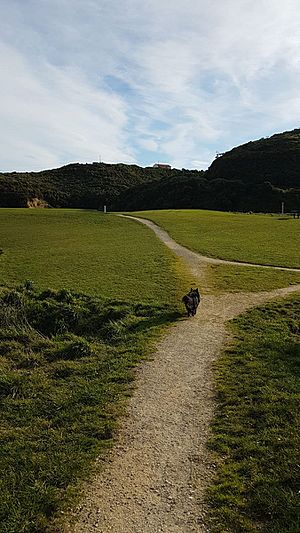
Newlands has many parks and reserves where people can enjoy nature and play. These include:
- Newlands Park
- Pinkerton Park
- Seton Nossiter Park
- Waihinahina Park
- Gilberd Bush Reserve
- Edgecombe Street play area
- Kenmore Street Play Area
- Lyndfield Lane play area
- Cheyne Walk play area
- Salford Street Play Area
Places of Worship
Newlands is home to several religious sites for different faiths:
- St. Michael and All Angels Anglican Church
- St. Andrews Catholic Church
- Newlands Baptist Church
- Newlands Christian Assembly
- Kingdom Hall of Jehovahs Witnesses
- Kurinchi Kumaran Temple
- Hare Krishna (ISKCON) Temple
Getting Around (Transport)
Roads
Newlands is connected to Ngauranga and the rest of Wellington by the Ngauranga Gorge. To the north, you can reach Porirua through Stewart Drive and Johnsonville. These roads connect to State Highway 1, which was built in the 1960s.
Bus Services
Newlands has several bus services. These buses connect Newlands to the wider Wellington area. Newlands Coach Services operates these buses for Metlink Wellington. Many of these bus routes also link Newlands to nearby Johnsonville. In Johnsonville, you can find even more transport options.
Newlands Coach Services has a bus depot. It is located next to the State Highway 1 overbridge.
Learning in Newlands (Education)
School Zones
Newlands is in the enrollment zones for several schools. These include Newlands College, Newlands School, and St Oran's College. This means students living in Newlands can attend these schools.
High Schools
Newlands College is a state high school for both boys and girls. It is located on Bracken Road in Newlands. As of February 2024. , it has a roll of 1,232 students.
Primary and Intermediate Schools
Newlands has three primary schools and one intermediate school:
- Newlands Intermediate is on Bracken Road, right next to Newlands College. It has a roll of 508 students as of February 2024. .
- Newlands School is a primary school on Newlands Road. It has a roll of 294 students.
- Rewa Rewa School is a primary school on Padnell Crescent. It has a roll of 143 students.
- Bellevue School is a primary school on Bancroft Terrace. It has a roll of 259 students.
 | Chris Smalls |
 | Fred Hampton |
 | Ralph Abernathy |


