Newtonferry facts for kids
Quick facts for kids Newtonferry
|
|
|---|---|
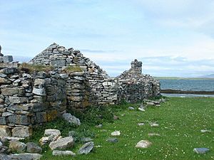
 Old steadings at Port nan Long |
|
| Language | Scottish Gaelic English |
| OS grid reference | NF894782 |
| Civil parish | |
| Council area | |
| Lieutenancy area | |
| Country | Scotland |
| Sovereign state | United Kingdom |
| Post town | ISLE OF NORTH UIST |
| Postcode district | HS6 |
| Dialling code | 01876 |
| Police | Northern |
| Fire | Highlands and Islands |
| Ambulance | Scottish |
| EU Parliament | Scotland |
| UK Parliament |
|
| Scottish Parliament |
|
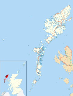
Newtonferry (which means "the harbour of the ships" in Scottish Gaelic, Port nan Long) is a small village on the beautiful island of North Uist in the Western Isles of Scotland. It's a special kind of community called a crofting community, located right at the end of the B893 road. Newtonferry is part of the larger area known as the parish of North Uist.
Discovering Newtonferry: A Scottish Island Community
Newtonferry is a quiet and charming place in the Outer Hebrides, a group of islands off the west coast of Scotland. It's known as a crofting community. A croft is a small farm, and crofting is a traditional way of life where people farm small plots of land. This often involves raising animals like sheep or cattle and growing crops. It's a very important part of the culture and history of these Scottish islands.
Connecting Islands: The Ferry and Causeway
For a long time, Newtonferry was an important connection point for travelers. A ferry boat used to sail from Newtonferry to the nearby island of Berneray. This ferry was a vital link for people and goods moving between the two islands.
However, things changed when a permanent causeway was built. A causeway is like a bridge or a raised road that connects two pieces of land across water. This causeway now links Berneray directly to North Uist, so the ferry service from Newtonferry is no longer needed. The causeway makes it much easier and faster for people to travel between the islands today.
Traces of the Past: Archaeological Finds
Even though Newtonferry is a small community, the area around it holds many secrets from the past. Archaeologists, who are like history detectives, have found several interesting archaeological sites nearby. These sites are places where people lived or worked many years ago. They can include old buildings, tools, or other objects that tell us about the lives of people who lived there long ago. These discoveries help us understand the rich history of North Uist and its early inhabitants.
 | Sharif Bey |
 | Hale Woodruff |
 | Richmond Barthé |
 | Purvis Young |


