
Newtonville Historic District facts for kids
|
Newtonville Historic District
|
|

Walnut Street in Newtonville
|
|
| Lua error in Module:Location_map at line 420: attempt to index field 'wikibase' (a nil value). | |
| Location | Newton, Massachusetts |
|---|---|
| Area | 40.5 acres (16.4 ha) (original) 7.8 acres (3.2 ha) (1990 increase) |
| Architect | Brown, Samuel J.; Et al. |
| Architectural style | Colonial Revival, Greek Revival, Late Victorian |
| MPS | Newton MRA |
| NRHP reference No. | 86001753 (original) 90000014 (increase) |
Quick facts for kids Significant dates |
|
| Added to NRHP | September 04, 1986 |
| Boundary increase | February 6, 1990 |
The Newtonville Historic District is a special area in Newtonville, a village within Newton, Massachusetts. This district is important because it protects old buildings and places that show the history of the area. It includes the southern part of the village's main shopping area and the homes around it. This historic district was added to the National Register of Historic Places in 1986 and was made larger in 1990.
Contents
What is the Newtonville Historic District?
The Newtonville Historic District is found in the middle of Newton. It is located between two main roads, Massachusetts Route 16 to the north and Commonwealth Avenue (Massachusetts Route 30) to the south. The main shopping area of Newtonville is around the intersection of Walnut and Washington Streets. The Massachusetts Turnpike and the MBTA train tracks run through the area, dividing the business district.
Homes and Shops in the District
The historic district includes many old homes, especially those built in the Victorian style. These homes are mostly south of the main shopping area. It also covers the southern part of the business district along Walnut Street.
When the district was first recognized in 1986, it had two main parts:
- Highland and Otis Streets, between Lowell and Walnut Streets.
- Walnut Street, between Cabot Street and Dexter Avenue.
In 1990, the district grew to include more areas. This included Birch Hill Road, more houses on Lowell Street, and the business area on Walnut Street south of the train tracks.
How Did Newtonville Grow?
Newtonville was not very developed in the mid-1800s, even though train tracks were already there.
Early Development by William Claflin
In the 1850s, a man named William Claflin bought a large piece of land. This land is now mostly where Newton North High School is. Claflin started to develop the area and encourage people to move there. The biggest period of growth for Newtonville was between about 1880 and 1900.
The Claflin Block, built in 1874, was the first major commercial building in the area. William Claflin also built many beautiful Victorian-style houses along Walnut Street. He built these houses to sell them. The Claflin School, which is also a historic site, was built because of his efforts.
Changes to the Business District
Over time, the business district faced some challenges. Washington Street was made wider, and the train tracks were lowered. Also, the Massachusetts Turnpike was built. These changes led to the old Newtonville train station from 1880 being torn down. They also divided the business district into different parts.
Important Buildings in the District
Several important buildings are part of the Newtonville Historic District. These buildings help tell the story of the area's past.
- The Claflin School: This school is also listed separately as an important historic place.
- Church of the Open Word: A significant church in the area.
- First Church of Christ, Scientist: Another important religious building.
- The Masonic Building: A notable building used by the Masons.
Images for kids
-
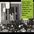
Famous poet Robert Frost at the Newtonville Library Dedication in 1939.
-
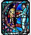
A beautiful window at the Newtonville Branch Library (1939) by artist Charles Jay Connick. It features a line from a poem by Robert Frost.


