Nine Mile Creek Regional Trail facts for kids
Quick facts for kids Nine Mile Creek Regional Trail |
|
|---|---|

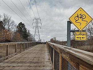
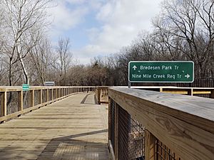
An elevated boardwalk section of Nine Mile Creek Regional Trail in Edina.
|
|
| Information | |
| Established | 2018 |
| Length | 15.30 miles (24.62 km) |
| Location | Hopkins, Minnetonka, Edina, Richfield, and Bloomington |
| Designation | Regional |
| Use | Mixed use |
| Cycling details | |
| Trail difficulty | Easy |
| Season | All |
| Sights | Marsh, local parks |
| Hazards | At-grade crossings, slippery surfaces |
| Surface | Asphalt, wood |
The Nine Mile Creek Regional Trail is a cool path for walking, biking, and running in Hennepin County, Minnesota. It stretches for about 15.3-mile (24.6 km), which is a little over 24 kilometers!
This trail is looked after by the Three Rivers Park District. A special part of the trail is its 8 boardwalks. These wooden paths cover about 1.7 miles (2.7 km) and go right over Nine Mile Creek and its marshy areas. Lots of people use this trail, with an estimated 400,000 visitors each year!
Exploring the Trail
The Nine Mile Creek Trail starts in Hopkins. Here, it connects with two other trails: the Cedar Lake LRT Regional Trail and the Minnesota River Bluffs Regional Trail.
As you head south from Hopkins, the trail crosses the creek many times. It takes a short break near US 169, where you use local streets for a bit.
The trail then picks up again in Edina. You'll go over several more boardwalks. It passes through Walnut Ridge Park and then Bredesen Park. A long bridge, about 588 feet (179 m) (179 meters) long, takes you over MN 62.
You'll also pass behind schools, including Edina High School, and cross another boardwalk. The trail then turns south near Tracy Avenue. One of the longest boardwalks on the trail runs next to Heights Park. It also follows power lines and a railway.
The trail goes under 70th Street and through an office area. It crosses a local road and then MN 100 on a 1,025 feet (312 m) (312 meter) bridge. After following MN 100, it heads east into the old Fred Richards Golf Course.
You'll pass north of Centennial Lakes Park and into Adams Hill Park. The trail briefly turns south and then follows 77th Street. Finally, it turns east to cross I-35W at 76th Street. It continues east on this road and ends at 12th Avenue.
How the Trail Was Built
Building the Nine Mile Creek Trail was a big project! Most of the trail in Richfield and Bloomington was built between 2000 and 2014. This part of the trail was originally about 9.2 miles (14.8 km) (14.8 kilometers) long and often ran along existing roads.
Building the trail in Edina was much harder. There wasn't much space, and the creek and roads were in the way. The builders needed permission from 19 different landowners. They also worked closely with the Minnesota Department of Transportation and the city.
The cool wooden boardwalks you see were actually made on farms in Oregon! There's a huge amount of wood used, over 1,100,000 square feet (100,000 m2) (102,193 square meters) of material. Some roads even had to be made narrower to fit the trail without touching private property. In one spot, the trail was squeezed between a freeway ramp and private land with less than 3 inches (7.6 cm) (7.6 centimeters) to spare!
The entire trail, including the boardwalks and bridges, was built over an area that can flood every 100 years. Two very long bridges were built: one over MN 100 (1,025 feet (312 m)) and another over MN 62 (588 feet (179 m)). The whole trail was finally finished and opened on June 3, 2018.
 | Tommie Smith |
 | Simone Manuel |
 | Shani Davis |
 | Simone Biles |
 | Alice Coachman |


