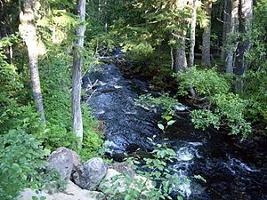
North Fork Breitenbush River facts for kids
Quick facts for kids North Fork Breitenbush River |
|
|---|---|

Near the headwaters
|
|
|
Location of the mouth of the North Fork Breitenbush River in Oregon
|
|
| Country | United States |
| State | Oregon |
| County | Marion |
| Physical characteristics | |
| Main source | Papoose Lakes Mount Hood National Forest, Cascade Range 5,731 ft (1,747 m) 44°45′17″N 121°46′38″W / 44.75472°N 121.77722°W |
| River mouth | Breitenbush River near Breitenbush Hot Springs 2,277 ft (694 m) 44°46′47″N 121°57′53″W / 44.77972°N 121.96472°W |
The North Fork Breitenbush River is a cool river in Oregon, a state in the United States. It's like a smaller stream that eventually joins a bigger river called the Breitenbush River. This river starts high up in the mountains and flows through beautiful forests.
Where Does the River Start?
The North Fork Breitenbush River begins at some lakes called Papoose Lakes. These lakes are located near Breitenbush Lake in the Cascade Range. This mountain range is north of a big mountain called Mount Jefferson.
The River's Journey
As the river flows, it generally heads northwest and then west. It travels through several important natural areas. These include the Mount Hood National Forest, the Olallie Scenic Area, and the Mount Jefferson Wilderness. It also passes through the Willamette National Forest.
The North Fork Breitenbush River eventually meets up with another river. This other river is called the South Fork Breitenbush River. When they join, they form the main part of the Breitenbush River. This meeting point is a little bit upstream from a place called Breitenbush Hot Springs.
River Branches
The North Fork Breitenbush River has a few smaller streams that flow into it. These are called tributaries. From where the river starts to where it ends, its three main named tributaries are:
- South Fork North Fork Breitenbush River
- Mink Creek
- Rapidan Creek
 | Chris Smalls |
 | Fred Hampton |
 | Ralph Abernathy |


