North Fork Humboldt River facts for kids
Quick facts for kids North Fork Humboldt River |
|
|---|---|

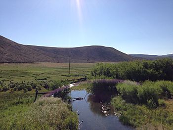
View downstream along the North Fork Humboldt River from Nevada State Route 225
|
|

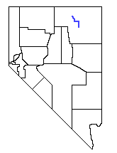
Map of the North Fork Humboldt River
|
|
| Country | United States |
| State | Nevada |
| County | Elko County |
| Physical characteristics | |
| Main source | Independence Mountains 8,380 ft (2,550 m) 41°33′04″N 115°59′32″W / 41.551133°N 115.992092°W |
| River mouth | Humboldt River 5,194 ft (1,583 m) 40°55′30″N 115°33′04″W / 40.924976°N 115.551003°W |
The North Fork of the Humboldt River is a river about 70 miles (110 km) long. It flows into the Humboldt River in northern Elko County, Nevada.
River's Journey: Where Does It Flow?
The North Fork Humboldt River starts high up in the Independence Mountains of northeastern Nevada. Its very beginning, called the headwaters, is on the north slopes of McAfee Peak.
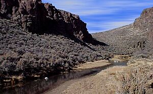
It quickly flows out of the mountains and heads south for about 25 miles (40 km). Many smaller streams join it along the way. Then it makes a sharp turn east, flowing through a narrow canyon called Devil's Gap. After that, it meets Beaver Creek and turns south again.
After a long journey through dry hills, the river often has only a small amount of water left. It finally flows into the main Humboldt River. This meeting point is about 15 miles (24 km) northeast of the city of Elko.
A Look Back: History of the River Area
The area around the North Fork Humboldt River is quite remote. Around 1870, some mining took place there. Later, people started raising cattle, and by the 1890s, sheep ranching became common.
Over time, too many animals grazing caused problems like soil erosion in the Independence Mountains. These mountains are where the river begins. To protect the land, the government created the Independence Forest Reserve in 1906. This reserve is now part of the Mountain City Ranger District within the Humboldt-Toiyabe National Forest.
 | Audre Lorde |
 | John Berry Meachum |
 | Ferdinand Lee Barnett |


