Independence Mountains facts for kids
Quick facts for kids Independence Mountains |
|
|---|---|
 |
|
| Highest point | |
| Peak | McAfee Peak |
| Elevation | 10,438 ft (3,182 m) |
| Dimensions | |
| Length | 70 mi (110 km) North-South |
| Geography | |
| Country | United States |
| State | Nevada |
| Range coordinates | 41°31′N 115°58′W / 41.52°N 115.97°W |
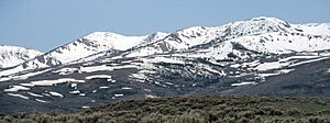
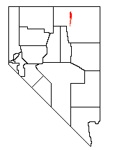
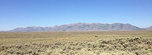
The Independence Mountains are a long mountain range located in northern Nevada, in the United States. People who speak the Shoshoni language call these mountains Settoya. The highest point in the range is McAfee Peak, which stands at about 10,439 feet (3,182 meters) tall.
This mountain range stretches for about 70 miles (113 kilometers) from a town called Carlin in the south, all the way north to the Owyhee River. To the east of the mountains, you'll find the North Fork of the Humboldt River. To the west is the Owyhee Desert. The main part of the Humboldt River flows south of the mountains. Near the northern end of the range, there's a fun place called the Wild Horse State Recreation Area.
Exploring the Independence Mountains
The Independence Mountains are part of two different water systems. The Owyhee River eventually flows into the Snake River and then the Columbia River. The Humboldt River, however, stays within the Great Basin, which means its water doesn't flow out to the ocean.
Southern Peaks and Passes
Starting about seven miles north of Carlin, the mountains begin to rise. One of the first notable peaks is Swales Mountain, which is about 8,068 feet (2,459 meters) high. After Swales Mountain, the land dips down into an area with smaller hills and buttes.
Then, the mountains rise again to Lone Mountain, also known as Nannies Peak, which reaches about 8,780 feet (2,676 meters). The range then drops quite low, almost to the level of the surrounding valleys. This lower area is where State Route 226 crosses, connecting to the small community of Tuscarora.
Northern Heights
North of State Route 226, the mountains get much taller very quickly. The main ridge includes several high peaks. These include Wheeler Mountain, which is 9,057 feet (2,761 meters) tall, and Jack's Peak, standing at 10,198 feet (3,108 meters). Finally, the highest point of the entire range is McAfee Peak, as mentioned earlier.
Most of the Independence Mountains north of State Route 226 are part of the Humboldt-Toiyabe National Forest. This means the area is protected and managed by the government, offering places for outdoor activities and preserving nature.
 | William Lucy |
 | Charles Hayes |
 | Cleveland Robinson |


