North Fork Smith River (California) facts for kids
Quick facts for kids North Fork Smith River |
|
|---|---|
|
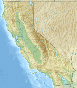
Location of the mouth of the North Fork Smith River in California
|
|
| Country | United States |
| State | Oregon, California |
| County | Curry County, Oregon, Del Norte County, California |
| Physical characteristics | |
| Main source | Klamath Mountains Chetco Peak, Kalmiopsis Wilderness, Curry County, Oregon 3,879 ft (1,182 m) 42°08′16″N 123°56′49″W / 42.13778°N 123.94694°W |
| River mouth | Smith River Gasquet, Del Norte County, California 315 ft (96 m) 41°50′52″N 123°58′08″W / 41.84778°N 123.96889°W |
| Length | 28 mi (45 km) |
| Basin features | |
| Basin size | 158 sq mi (410 km2) |
| Type: | Wild, Scenic |
| Designated: | October 28, 1988 |
The North Fork Smith River is a 28-mile (45 km) long river. It starts in Oregon and flows into California. This river begins near Chetco Peak in the Klamath Mountains. It flows south until it meets the Middle Fork Smith River near Gasquet, California. Together, they form the main Smith River.
Contents
A Special River
A big part of the North Fork Smith River is special. The 13 miles (21 km) of the river in Oregon are part of the National Wild and Scenic Rivers System. This system protects rivers for their natural beauty and importance.
In 1988, parts of the river were given special titles. About 8.5 miles (14 km) were called "wild." This means they are kept very natural and untouched. Another 4.5 miles (7.2 km) were called "scenic." These parts are beautiful and important to protect.
Fun Things to Do
The North Fork Smith River area is great for outdoor adventures. You can explore many trails and campgrounds.
Hiking and Horseback Riding
The North Fork Trail is a popular path. It follows a ridge in the Rogue River – Siskiyou National Forest in Oregon. This trail is 12.4 miles (20 km) long. It is good for both hikers and people riding horses. The trail goes through an area affected by the Biscuit Fire.
The Baldface Trail connects to the North Fork Trail. It crosses Baldface Creek, which flows into the North Fork. This trail is 6.8 miles (11 km) long. It is good for day hikes but not for horses. It also passes through the Biscuit Fire area.
The North Fork Trail also links to the Kalmiopsis Rim Trail. This trail is 28.4 miles (45.7 km) long. It connects to many other trails in the national forest.
Camping Spots
You can find a few places to camp along the river. Sourdough Campground is a simple, undeveloped spot. It is a meadow near where the North Fork meets Baldface Creek in Oregon. You can camp there in a spread-out way.
Further downstream, in California, is North Fork Campground. It is in Six Rivers National Forest. This campground is open all year. It has five spots for tents or trailers. Each spot has picnic tables and fire rings. There is also a vault toilet. Remember, there is no drinking water or trash service here.
Whitewater Boating
Some people enjoy whitewater rafting or kayaking on the river. The lower 13 miles (21 km) of the river in California are sometimes used. This part is rated Class III (intermediate) and Class IV (advanced). This means it can be challenging and is best for experienced boaters. The river can be hard to reach and sometimes does not have enough water for boating.
River Health
The North Fork Smith River has very clean water. It is not cloudy and has almost no pollution. Not much logging or road building has happened in its area. This helps keep the water clear, even after storms.
However, there is a concern about a possible nickel mine. This mine might be built along Baldface Creek. If it is built, it could pollute the river. This could harm fish like anadromous fish, which swim from the ocean to fresh water to lay eggs. Many groups are against this mining. These include local, state, and tribal agencies. Environmental, fishing, and recreation groups also oppose it. They want to protect the river's clean water and wildlife.
River Branches
Many smaller streams flow into the North Fork Smith River. These are called tributaries. From where the river starts to where it ends, some of the named tributaries are:
- Horse Creek
- Chrome Creek
- Hardrock Creek
- Packsaddle Gulch
- Baldface Creek
- Fall Creek
- Cedar Creek
- Diamond Creek
- Still Creek
- Stony Creek
 | Valerie Thomas |
 | Frederick McKinley Jones |
 | George Edward Alcorn Jr. |
 | Thomas Mensah |


