North Hartsville, South Carolina facts for kids
Quick facts for kids
North Hartsville, South Carolina
|
|
|---|---|

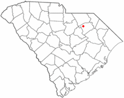
Location of North Hartsville, South Carolina
|
|
| Country | United States |
| State | South Carolina |
| County | Darlington |
| Area | |
| • Total | 4.54 sq mi (11.74 km2) |
| • Land | 4.53 sq mi (11.73 km2) |
| • Water | 0.01 sq mi (0.02 km2) |
| Elevation | 223 ft (68 m) |
| Population
(2020)
|
|
| • Total | 2,775 |
| • Density | 612.72/sq mi (236.59/km2) |
| Time zone | UTC-5 (Eastern (EST)) |
| • Summer (DST) | UTC-4 (EDT) |
| ZIP code |
29550
|
| Area code(s) | 843 and 854 |
| FIPS code | 45-51145 |
| GNIS feature ID | 1231599 |
North Hartsville is a special kind of community in Darlington County, South Carolina, United States. It's called a census-designated place (CDP). This means it's an area that the government counts as a town for statistics, but it doesn't have its own local government like a city or town.
In 2020, about 2,775 people lived in North Hartsville. It is part of the larger Florence Metropolitan Statistical Area. This is a region that includes several cities and towns that are closely connected. North Hartsville is also near the Hartsville Urban Cluster.
Contents
Geography of North Hartsville
North Hartsville is located in the northwestern part of Darlington County. You can find it at these coordinates: 34°23′45″N 80°4′13″W / 34.39583°N 80.07028°W.
To the south, North Hartsville is next to Hartsville. These two places are separated by Prestwood Lake and Black Creek. Hartsville is the biggest city in Darlington County.
Roads and Travel
The main road that goes through North Hartsville is Business Route 15. It is also known as N. 5th Street.
Another important road is South Carolina Highway 102, called Patrick Highway. This road starts from Business 15 on the east side of town and heads north.
- Society Hill is about 15 miles (24 km) northeast on US 15.
- Patrick is about 14 miles (23 km) north on SC 102.
- Darlington, which is the main town for the county, is about 15 miles (24 km) to the southeast.
Area Size
The United States Census Bureau collects information about places like North Hartsville. They say that North Hartsville covers a total area of about 4.54 square miles (11.8 square kilometers). Most of this area is land. Only a very small part, about 0.01 square miles (0.02 square kilometers), is water.
People of North Hartsville
| Historical population | |||
|---|---|---|---|
| Census | Pop. | %± | |
| 2020 | 2,775 | — | |
| U.S. Decennial Census | |||
The census is a count of people that happens every ten years. In 2000, there were 3,136 people living in North Hartsville. There were 1,226 households, which are groups of people living together in one home.
Population Details
The population of North Hartsville includes people of different ages:
- About 26.7% of the people were under 18 years old.
- About 7.0% were between 18 and 24 years old.
- About 30.1% were between 25 and 44 years old.
- About 25.6% were between 45 and 64 years old.
- About 10.6% were 65 years old or older.
The average age of people in North Hartsville was 36 years. For every 100 females, there were about 94 males.
Household Income
In 2000, the average income for a household in North Hartsville was $41,016 per year. For families, the average income was $47,566 per year. The average income for each person in the area was $22,376.
About 15.4% of all the people in North Hartsville lived below the poverty line. This included 22.2% of those under 18 and 15.2% of those aged 65 or older.
See also
 In Spanish: North Hartsville para niños
 | Bayard Rustin |
 | Jeannette Carter |
 | Jeremiah A. Brown |

