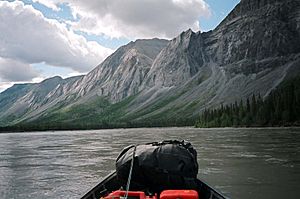
North Nahanni River facts for kids
Quick facts for kids North Nahanni River |
|
|---|---|
 |
|
| Country | Canada |
| Territory | Northwest Territories |
| Physical characteristics | |
| Main source | Backbone Ranges 2,000 meters (6,600 ft) 62°16′18″N 126°23′55″W / 62.27157°N 126.39859°W |
| River mouth | Mackenzie River 105 meters (344 ft) 62°14′44″N 123°19′43″W / 62.24557°N 123.32866°W |
The North Nahanni River is an important river located in the Northwest Territories of Canada. It is a big branch, also known as a major tributary, of the mighty Mackenzie River.
Journey of the River
The North Nahanni River begins its journey high up in the mountains. It starts in the Backbone Ranges, which are part of the Mackenzie Mountains. Here, the river's source is about 2,000 meters (6,600 ft) above sea level.
From its mountain source, the river flows generally towards the east. It passes by different mountain ranges like the Thundercloud Range. As it continues, it turns north-east and then east again.
Later, the river makes a turn south around the Camsell Range, which is part of the Franklin Mountains. Along this part of its path, it collects water from smaller streams. These include Deceiver Creek and Battlement Creek.
The North Nahanni River then turns east once more. It receives even more water from two other rivers, the Ram River and the Tetcela River. It flows between the Nahanni Range and the Camsell Range.
Finally, the river reaches its end point. It flows into the Mackenzie River at an elevation of about 105 meters (344 ft). This meeting point is about 110 kilometers (68 mi) downstream from the town of Fort Simpson.
Rivers Joining the North Nahanni
As the North Nahanni River travels from its beginning to its end, several smaller rivers and creeks join it. These are called tributaries. They add more water to the main river.
Here are some of the main tributaries that flow into the North Nahanni River:
- Deceiver Creek
- Battlement Creek
- Ram River
- Tetcela River
 | Shirley Ann Jackson |
 | Garett Morgan |
 | J. Ernest Wilkins Jr. |
 | Elijah McCoy |

