North Quincy, Massachusetts facts for kids
North Quincy is a lively neighborhood in Quincy, Massachusetts. It sits right next to the city of Boston, separated by the Neponset River. It also shares borders with other Quincy neighborhoods like Squantum, Montclair, and Wollaston. Inside North Quincy, you'll find smaller areas called Atlantic and Norfolk Downs. A big part of Wollaston Beach is also in this neighborhood.
Contents
A Look Back: North Quincy's History
Early Days: From Marsh to Race Track
Long ago, this area was mostly marshland and part of the Neponset River system. It was first known as Billings Plain. Local soldiers used this open space for training and parades. Later, in the 1800s, a race track run by the Jockey Club of Boston was built here.
A Changing Community
Since the late 1970s, many Chinese American and other Eastern Asian families have moved to North Quincy. Today, a large part of the neighborhood's population is Asian.
The area was once home to many Navy families. They lived in a large housing area north of Quincy Shore Drive. This housing was built for people working at the Squantum naval air base. Even after that base closed, Navy families from the South Weymouth NAS lived there until 1997. Now, these buildings have been changed into housing for older adults.
Major Businesses in North Quincy
Two big companies have important offices here. Blue Cross Blue Shield of Massachusetts and State Street Corporation have their main operations centers on Newport Avenue. These offices are very close to the subway station.
Getting Around: Transportation in North Quincy
Historic Train and Streetcar Routes
Starting in 1845, the Old Colony Railroad began serving this area. This train system connected many towns in the South Shore, Norfolk, and Plymouth Counties. The New York, New Haven and Hartford Railroad took over the system in 1893. North Quincy had two Old Colony train stations: Norfolk Downs Station and Atlantic Station.
The Eastern Massachusetts Street Railway also ran streetcars through the 1930s. These streetcars traveled along Hancock Street from Neponset Station in Boston to Quincy Center. There was also a branch route from Atlantic Station to Squantum.
Modern Public Transport
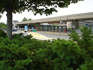
Today, the North Quincy station is a key part of the MBTA's Red Line. It opened in 1971 and is located across from North Quincy High School. Several MBTA bus routes also serve the neighborhood. Bus route 211 goes through North Quincy Station to Squantum. Route 210 travels down Hancock Street, and route 212 goes down Billings Road.
Main Roads
State Route 3A runs along Hancock Street. This road crosses the Neponset River Bridge, leading directly into Boston.
Learning in North Quincy: Education
Public Schools for Kids
North Quincy has public schools for different age groups. F. W. Parker Elementary School serves younger students. Atlantic Middle School is for middle schoolers.
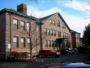
There was another elementary school, Quincy Elementary School, on Newbury Avenue. It closed in 1981 due to budget cuts. The building was later changed into apartments. In 1983, it was added to the National Register of Historic Places because of its historical importance.
North Quincy High School
North Quincy High School is located between Hancock and Hunt Streets. It is the main high school for students from North Quincy and nearby areas. The school had big renovations between 1970 and 1972, making it much larger. This expansion required removing Oliver Street and some homes on Hunt Street to create parking and access to sports fields.
College and Library Services
Quincy College once had facilities on Newport Avenue, near the subway station. These have since closed, and the college is now located downtown.
A branch of the Thomas Crane Public Library is on Hancock Street in Norfolk Downs. It is close to the MBTA station. Another library branch on Atlantic Street closed in 1980 due to budget cuts.
 | John T. Biggers |
 | Thomas Blackshear |
 | Mark Bradford |
 | Beverly Buchanan |


