
Northern Maine Regional Airport at Presque Isle facts for kids
Quick facts for kids
Northern Maine Regional Airport at Presque Isle
|
|||||||||||||||
|---|---|---|---|---|---|---|---|---|---|---|---|---|---|---|---|

USGS aerial photo as of 9 May 1996
|
|||||||||||||||
| Summary | |||||||||||||||
| Airport type | Public | ||||||||||||||
| Owner | City of Presque Isle | ||||||||||||||
| Serves | Presque Isle, Maine | ||||||||||||||
| Elevation AMSL | 534 ft / 163 m | ||||||||||||||
| Coordinates | 46°41′20″N 068°02′41″W / 46.68889°N 68.04472°W | ||||||||||||||
| Runway | |||||||||||||||
|
|||||||||||||||
| Statistics (2007) | |||||||||||||||
|
|||||||||||||||
|
Sources: airport website and FAA
|
|||||||||||||||

The Northern Maine Regional Airport (Airport Code KPQI) is a public airport located in the city of Presque Isle, Maine. It's a place where airplanes take off and land, connecting people and goods to other parts of the country. This airport is important for travel and business in northern Maine.
Contents
What is the Northern Maine Regional Airport?
The Northern Maine Regional Airport is a public airport. This means it's open for anyone to use, whether you're flying on a commercial airline or a private plane. It's owned by the City of Presque Isle. The airport has two main runways where planes land and take off. The longest runway is about 7,439 feet long, which is over 2,200 meters!
Where is the Airport Located?
The airport is in Presque Isle, Maine, a city in the northern part of the state. It sits about 534 feet (or 163 meters) above sea level. You can see its exact spot on a map using its coordinates: 46 degrees, 41 minutes, 20 seconds North, and 68 degrees, 2 minutes, 41 seconds West.
A Look Back: From Air Force Base to Airport
Before it was a public airport, this location had a very different job! It was once a military base called Presque Isle Air Force Base. This base was an important spot for the United States Air Force. It helped protect the country and was used for various military operations.
When Did the Air Force Base Close?
The Presque Isle Air Force Base closed down in 1961. After that, it was turned into the public airport we know today. This is a common story for many airports around the world. Old military bases often find new life as places for civilian travel.
Flights You Can Take
Even though it's a smaller airport, you can still catch flights from Northern Maine Regional Airport. Currently, US Airways Express flies between here and Boston, Massachusetts. This makes it easier for people in northern Maine to travel to a bigger city and connect to flights all over the world.
Airport Facts and Figures
Airports keep track of how busy they are. In 2007, there were 4,684 aircraft operations at this airport. An "aircraft operation" means one takeoff or one landing. So, planes landed or took off nearly 5,000 times that year! Also, in 2007, there were 22 aircraft that called this airport their home base.
Images for kids
-
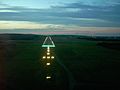
Runway 1 at night

