Oak Springs, Arizona facts for kids
Quick facts for kids
Oak Springs, Arizona
|
|
|---|---|

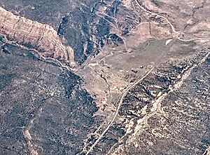
Aerial view of Oak Springs
|
|
| Country | United States |
| State | Arizona |
| County | Apache |
| Area | |
| • Total | 0.18 sq mi (0.48 km2) |
| • Land | 0.18 sq mi (0.48 km2) |
| • Water | 0.00 sq mi (0.00 km2) |
| Elevation | 6,582 ft (2,006 m) |
| Population
(2020)
|
|
| • Total | 54 |
| • Density | 293.48/sq mi (113.49/km2) |
| Time zone | UTC-7 (MST) |
| • Summer (DST) | UTC-6 (MDT) |
| ZIP code |
86505
|
| Area code(s) | 928 |
| FIPS code | 04-50480 |
| GNIS feature ID | 2582834 |
Oak Springs (called Teeł Chʼínítʼiʼ in the Navajo language) is a small community in Apache County, Arizona, United States. It is known as a census-designated place (CDP). This means it is a special area that the government counts for population, but it is not officially a city or town. In 2020, about 54 people lived in Oak Springs.
Where is Oak Springs Located?
Oak Springs is in the northeastern part of Arizona. It is found along a road called Indian Route 12. This community is about 10 miles (16 kilometers) north of Interstate 40. It is also about 13 miles (21 kilometers) south of a place called St. Michaels.
How Big is Oak Springs?
The total area of Oak Springs is quite small. It covers about 0.18 square miles (0.48 square kilometers). All of this area is land, with no water bodies like lakes or rivers.
Education in Oak Springs
Students in Oak Springs attend schools that are part of the Window Rock Unified School District. The main high school for the area is Window Rock High School.
There are also two other schools nearby that serve students from Oak Springs. These schools are Cove Day School and Red Rock Day School. They are operated by the Bureau of Indian Education (BIE).
See also
 In Spanish: Oak Springs (Arizona) para niños
 | Audre Lorde |
 | John Berry Meachum |
 | Ferdinand Lee Barnett |


