St. Michaels, Arizona facts for kids
Quick facts for kids
St. Michaels, Arizona
|
|
|---|---|

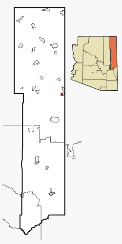
Location in Apache County and the state of Arizona
|
|
| Country | |
| State | |
| County | Apache |
| Area | |
| • Total | 3.82 sq mi (9.89 km2) |
| • Land | 3.82 sq mi (9.89 km2) |
| • Water | 0.00 sq mi (0.00 km2) |
| Elevation | 6,815 ft (2,077 m) |
| Population
(2020)
|
|
| • Total | 1,384 |
| • Density | 362.40/sq mi (139.92/km2) |
| Time zone | UTC-7 (MST) |
| • Summer (DST) | UTC-6 (MDT) |
| ZIP code |
86511
|
| FIPS code | 04-62420 |
| GNIS feature ID | 2409230 |
St. Michaels (pronounced "Saint Michaels") is a small community in Arizona, United States. It is part of the Navajo Nation, which is the largest Native American reservation in the United States. St. Michaels is located in Apache County. The main government offices for the Navajo Nation are very close by, in a place called Window Rock. In 2020, about 1,384 people lived here.
Contents
Geography of St. Michaels
St. Michaels is found on the eastern edge of the Defiance Plateau. It sits on the western side of the Black Creek Valley, near a stream called Black Creek. This stream flows into the Rio Puerco.
The total area of St. Michaels is about 9.9 square kilometers (or 3.8 square miles). All of this area is land, with no water.
History of the Area
The area where St. Michaels is located has a special name in the Navajo language: Tsʼíhootso. This name means "area that extends out in yellow and green."
Early on, people called this place Ciénega Amarilla, which is Spanish for "yellow meadow." This name described the yellow flowers and grass that grew there in late summer. In 1850, a U.S. military officer named Lt. James Harvey Simpson heard the Spanish name incorrectly. He wrote it down as Sieneguilla de Maria.
Saint Michael Convent and Mission
In 1896, construction began on the Franciscan Mission in St. Michaels. The money for this project came from Rev. Mother Katharine Drexel. She was the founder of the Sisters of the Blessed Sacrament.
Rev. Anselm Weber took over the construction on October 11, 1897. He decided to name the area "Saint Michaels." This name came from the Navajo word Tsʼíhootso, meaning "Green Meadow." The St. Michael Parish was officially started in 1898.
Later, in 1910, a priest named Fr. Berard Haile worked at the Franciscan Mission. He created a dictionary of the Navajo language and its culture.
Population and People
The number of people living in St. Michaels has changed over the years:
| Historical population | |||
|---|---|---|---|
| Census | Pop. | %± | |
| 1990 | 1,119 | — | |
| 2000 | 1,295 | 15.7% | |
| 2010 | 1,443 | 11.4% | |
| 2020 | 1,384 | −4.1% | |
| source: | |||
In 2000, there were 1,295 people living in St. Michaels. Most of the people living here were Native Americans. About 7% were White.
The average age of people in St. Michaels in 2000 was 24 years old. Many households had children under 18 living with them.
Schools and Education
St. Michaels is part of the Window Rock Unified School District. Students in the area attend:
- Window Rock Elementary School
- Tse Ho Tso Middle School
- Window Rock High School
There is also a private, Catholic school in the community called the Saint Michael Indian School. This school teaches students from kindergarten all the way through 12th grade. It was started in 1902 by Saint Katharine Drexel.
Another school nearby is the Hunters Point Boarding School. This is a tribal elementary school that works with the Bureau of Indian Education (BIE). It also uses a St. Michaels postal address.
See also
 In Spanish: St. Michaels (Arizona) para niños
 | Tommie Smith |
 | Simone Manuel |
 | Shani Davis |
 | Simone Biles |
 | Alice Coachman |


