Ocós facts for kids
Quick facts for kids
Ocós
|
|
|---|---|
|
Municipality
|
|
 |
|
| Country | Guatemala |
| Department | San Marcos |
| Area | |
| • Municipality | 50.8 km2 (19.6 sq mi) |
| Population
(2018 census)
|
|
| • Municipality | 10,841 |
| • Density | 213/km2 (550/sq mi) |
| • Urban | 4,417 |
| Climate | Aw |
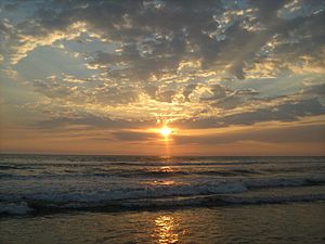
Ocós is a municipality (a type of local government area) in the San Marcos Department of Guatemala. It is located on the Pacific Ocean coast. Ocós is very close to the border with Mexico. It sits at about 4 meters (13 feet) above sea level. Two large rivers, the Suchiate and the Naranjo, flow nearby. On January 23, 2014, Ocós lost about two-thirds of its land. This happened when a place called La Blanca became its own separate municipality.
Contents
History of Ocós
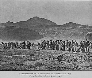
The 1897 Quetzaltenango Uprising
In September 1897, a big event happened in Guatemala. The country was facing serious money problems. The prices of coffee and silver, which were very important for Guatemala's economy, had dropped a lot. Also, some big projects, like a special railroad and a large expo, had failed.
Because of these problems, people in Quetzaltenango were unhappy. They protested against President José María Reina Barrios. He wanted to stay president until 1902, which was longer than many thought fair.
A group of rebels, including a former government official named Próspero Morales, started fighting on September 7, 1897. They first attacked San Marcos. After several battles, they gained some ground in Ocós, Coatepeque, and Colomba. However, the rebels were finally defeated on October 4, 1897. As a result of this uprising, San Pedro Sacatepéquez became the new capital of the San Marcos Department on October 23, 1897.
La Blanca Becomes Separate
On January 23, 2014, a part of Ocós called La Blanca officially separated. The Congress of Guatemala voted to approve this split. This meant that Ocós lost about 66% of its land and population. La Blanca then became the thirtieth municipality in the San Marcos Department.
Climate in Ocós
Ocós has a tropical savanna climate. This type of climate is known for being warm all year round. It also has a wet season and a dry season. The weather in Ocós is classified as Aw according to the Köppen climate classification system.
| Climate data for Ocós | |||||||||||||
|---|---|---|---|---|---|---|---|---|---|---|---|---|---|
| Month | Jan | Feb | Mar | Apr | May | Jun | Jul | Aug | Sep | Oct | Nov | Dec | Year |
| Mean daily maximum °C (°F) | 34.1 (93.4) |
34.4 (93.9) |
35.4 (95.7) |
35.5 (95.9) |
35.1 (95.2) |
33.6 (92.5) |
34.0 (93.2) |
34.1 (93.4) |
33.6 (92.5) |
33.6 (92.5) |
33.7 (92.7) |
33.5 (92.3) |
34.2 (93.6) |
| Daily mean °C (°F) | 26.7 (80.1) |
27.0 (80.6) |
28.3 (82.9) |
29.1 (84.4) |
29.2 (84.6) |
28.3 (82.9) |
28.3 (82.9) |
28.4 (83.1) |
28.1 (82.6) |
28.1 (82.6) |
27.6 (81.7) |
26.8 (80.2) |
28.0 (82.4) |
| Mean daily minimum °C (°F) | 19.3 (66.7) |
19.7 (67.5) |
21.2 (70.2) |
22.7 (72.9) |
23.4 (74.1) |
23.1 (73.6) |
22.7 (72.9) |
22.7 (72.9) |
22.7 (72.9) |
22.6 (72.7) |
21.6 (70.9) |
20.2 (68.4) |
21.8 (71.3) |
| Average precipitation mm (inches) | 4 (0.2) |
0 (0) |
4 (0.2) |
35 (1.4) |
107 (4.2) |
259 (10.2) |
162 (6.4) |
171 (6.7) |
259 (10.2) |
209 (8.2) |
30 (1.2) |
4 (0.2) |
1,244 (49.1) |
| Source: Climate-Data.org | |||||||||||||
See also
 In Spanish: Ocós para niños
 | Janet Taylor Pickett |
 | Synthia Saint James |
 | Howardena Pindell |
 | Faith Ringgold |


