Coatepeque, Quetzaltenango facts for kids
Quick facts for kids
Coatepeque
|
||
|---|---|---|
|
Municipality and town
|
||
|
||
| Country | ||
| Department | ||
| Area | ||
| • Total | 164 sq mi (426 km2) | |
| Elevation | 1,634 ft (498 m) | |
| Population
(2018 census)
|
||
| • Total | 105,415 | |
| • Density | 640.9/sq mi (247.45/km2) | |
| Time zone | UTC+6 (Central Time) | |
| Climate | Am | |
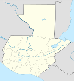
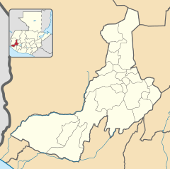
Coatepeque (pronounced ko-ah-teh-PEH-keh) is a lively town and a municipality in the Quetzaltenango department of Guatemala. It's sometimes called the "Village of Gardenias." In 2018, about 37,330 people lived in the town itself.
Coatepeque is located close to the Suchiate River. It's also an important place for travel and transport along the Pacific Coast Highway.
Contents
What's the Weather Like in Coatepeque?
Coatepeque has a tropical monsoon climate. This means it has two main seasons: a dry season and a wet season.
- Dry Season: From December to March, there isn't much rain.
- Wet Season: From April to November, it rains a lot, sometimes very heavily.
| Climate data for Coatepeque | |||||||||||||
|---|---|---|---|---|---|---|---|---|---|---|---|---|---|
| Month | Jan | Feb | Mar | Apr | May | Jun | Jul | Aug | Sep | Oct | Nov | Dec | Year |
| Mean daily maximum °C (°F) | 30.4 (86.7) |
30.8 (87.4) |
32.3 (90.1) |
32.2 (90.0) |
32.0 (89.6) |
30.6 (87.1) |
31.4 (88.5) |
31.5 (88.7) |
30.9 (87.6) |
30.2 (86.4) |
30.4 (86.7) |
30.1 (86.2) |
31.1 (87.9) |
| Daily mean °C (°F) | 24.0 (75.2) |
24.3 (75.7) |
25.7 (78.3) |
26.2 (79.2) |
26.3 (79.3) |
25.5 (77.9) |
25.9 (78.6) |
26.0 (78.8) |
25.7 (78.3) |
25.0 (77.0) |
24.9 (76.8) |
24.1 (75.4) |
25.3 (77.5) |
| Mean daily minimum °C (°F) | 17.6 (63.7) |
17.9 (64.2) |
19.1 (66.4) |
20.3 (68.5) |
20.6 (69.1) |
20.5 (68.9) |
20.4 (68.7) |
20.5 (68.9) |
20.5 (68.9) |
19.9 (67.8) |
19.5 (67.1) |
18.2 (64.8) |
19.6 (67.2) |
| Average precipitation mm (inches) | 18 (0.7) |
24 (0.9) |
68 (2.7) |
195 (7.7) |
417 (16.4) |
666 (26.2) |
496 (19.5) |
614 (24.2) |
694 (27.3) |
648 (25.5) |
154 (6.1) |
37 (1.5) |
4,031 (158.7) |
| Source: Climate-Data.org | |||||||||||||
Ancient History: Takalik Abaj
Near Coatepeque, you can find an amazing ancient site called Takalik Abaj. This place has important archaeological remains from old civilizations.
Sports in Coatepeque
Coatepeque is home to a football (soccer) team called Deportivo Coatepeque. They are also known as the "Serpientes Rojas" (Red Snakes).
- League: They play in the Liga Nacional, which is the top football league in Guatemala.
- Home Stadium: Their home games are played at the Israel Barrios Stadium. This stadium has natural grass and can hold up to 24,000 fans!
Where is Coatepeque Located?
The main urban area of Coatepeque has 22 neighborhoods. The rural areas around it include 15 medium-sized villages and 25 smaller ones.
Coatepeque is located about 40 kilometers (about 25 miles) southwest of Quetzaltenango city.
 |
Nuevo Progreso and El Quetzal, San Marcos municipalities Colomba Costa Cuca, Quetzaltenango municipality |
 |
||
| Pajapita, Ocós and Tecún Umán, San Marcos municipalities | Flores Costa Cuca, Quetzaltenango municipality | |||
| Retalhuleu, Retalhuleu municipality Génova, Quetzaltenango municipality Ocós, San Marcos municipality |
See also
 In Spanish: Coatepeque (Quetzaltenango) para niños
 | Ernest Everett Just |
 | Mary Jackson |
 | Emmett Chappelle |
 | Marie Maynard Daly |


