Offaly Way facts for kids
Quick facts for kids Offaly Way |
|
|---|---|

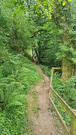
Trail near Silver River, Cadamstown
|
|
| Length | 37 km (23 mi) |
| Location | County Offaly, Ireland |
| Designation | National Waymarked Trail |
| Trailheads | Cadamstown, Lemanaghan |
| Use | Hiking |
| Highest point | 140 metres (459 ft) |
| Difficulty | Easy |
| Season | Any |
The Offaly Way (Irish: Slí Uíbh Fhailí) is a special long walking path in County Offaly, Ireland. It's like a super-long hiking trail that takes you through different parts of the county.
This trail is about 37 kilometers (or 23 miles) long. It starts in a place called Cadamstown and finishes in Lemanaghan. You can find Lemanaghan between the towns of Clara and Ferbane. Most people take about two days to walk the entire Offaly Way.
The Offaly Way is officially known as a National Waymarked Trail. This means it's a well-known and cared-for path for walkers in Ireland. It's looked after by groups like Offaly County Council and others. This trail also connects to other famous paths, like the Slieve Bloom Way and the Grand Canal Way.
Exploring the Offaly Way
The Offaly Way takes you on an exciting journey through nature and history. It's a great way to see the beautiful countryside of County Offaly.
Where Does the Trail Go?
The adventure begins in Cadamstown. From there, the path follows an old "mass path" along the Silver River. A mass path was a special route people used long ago to walk to church. This part of the trail leads you to Kilcormac.
Next, the trail crosses Boora Bog. A "bog" is a type of wetland, like a marshy area. Boora Bog is very interesting because it has signs of ancient human life from the Mesolithic period. This was a time thousands of years ago, when people were hunter-gatherers.
After the bog, you'll pass through the Turraun Nature Reserve. This is a protected area where you can see different plants and animals. Finally, the trail crosses the Grand Canal and follows the River Brosna all the way to Lemanaghan.
 | Sharif Bey |
 | Hale Woodruff |
 | Richmond Barthé |
 | Purvis Young |

