Old John facts for kids
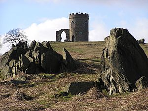
Old John is the highest hill in Bradgate Park, Leicestershire, England. It sits on the edge of Charnwood Forest. This famous hill is named after the tower that stands on its top. Old John Hill is about 212 meters (696 feet) high. It is a well-known landmark you can see from many places across Leicester and Leicestershire.
Contents
Old John Tower: A Historic Landmark
The name "Old John" first appeared on a map in 1754. At that time, a windmill stood on the site. The tower you see today was built much later, in 1784. It was designed to look like an old ruin, which is called a "folly." George Grey, 5th Earl of Stamford had it built.
The Tower's Changing Uses
In the mid-1800s, the tower was changed by the seventh Earl. He used it as a viewing spot for his horses' training track. A stable block was also built lower down the hill. The tower is famous for its "mug-shape." This is because a longer wall that was once attached to it got smaller over time. This left the tower looking like a mug with a handle. Some people tell stories about a beer-loving miller and a bonfire. But these stories about the mug shape are not true.
In the past, the tower was a meeting place for hunters. It was also used for lunch parties during shooting events. This was before Bradgate Park became open to everyone in 1928. Inside, the tower still has parts from the 1800s. These include wooden floors, stone fireplaces, and windows with shutters. The roof looks like a castle. The tower is a "Grade II listed building." This means it is an important historic building. You can climb a narrow spiral staircase inside the tower. It is open to visitors during the park's guided tours.
In 2001, the Bradgate Park Trust protected the tower's design. This means they own the rights to its image. In 2018, they asked an artist to pay if she wanted to keep selling paintings of the tower.
Toposcope: See What's Around You
Next to the tower, there is a special map called a toposcope. It was put there in 1953. The people of Newtown Linford paid for it. They raised money from a show about Lady Jane Grey. This show celebrated 400 years since she was named Queen of England. A toposcope helps you identify landmarks in the distance.
War Memorial: Remembering Heroes
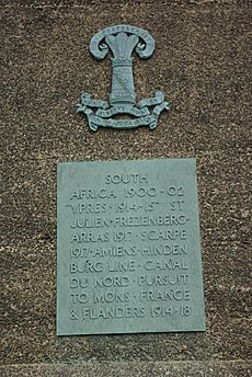
Old John Tower is at one end of a long ridge. In the middle of this ridge is a wooded area called Old John Spinney. At the other end of the ridge, also 212 meters high, is the Leicestershire Yeomanry War Memorial. This memorial was built around 1920. It honors soldiers from the Leicestershire Yeomanry who died in the Second Boer War (1900-1902) and World War I. Later, another plaque was added after World War II. Every year, a special ceremony is held here. People lay wreaths to remember the soldiers. This happens around the date of the Battle of Frezenberg, which was fought in France on May 13, 1915.
Visiting Old John: How to Get There
Bradgate Park is open to visitors during daylight hours. There are three car parks where you can pay to park. The car park furthest north is the closest to Old John. It is officially called Hunts Hill Car Park. However, most people just call it the "Old John Car Park."
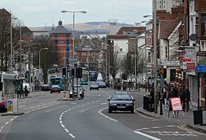
The unique shape of Old John Hill and its tower can be seen from many parts of Leicester. It is also visible from the surrounding county. This makes it a very special and important place for the people of Leicestershire.
 | Jessica Watkins |
 | Robert Henry Lawrence Jr. |
 | Mae Jemison |
 | Sian Proctor |
 | Guion Bluford |


