Onemen Bay facts for kids
Quick facts for kids Onemen Bay |
|
|---|---|
| Онемен / Onmyn | |

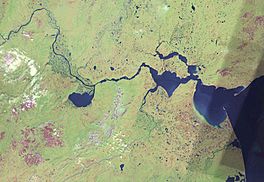
View of the area with Onemen Bay roughly in the middle.
|
|
| Location | Arctic |
| Coordinates | 64°42′58″N 176°43′43″E / 64.71611°N 176.72861°E |
| River sources | Anadyr River |
| Ocean/sea sources | Anadyr Estuary Gulf of Anadyr, Bering Sea |
| Basin countries | Russia |
| Max. length | 40 km (25 mi) |
| Max. width | 5 km (3.1 mi) |
| Average depth | 20 m (66 ft) |
| Settlements | Tavayvaam |
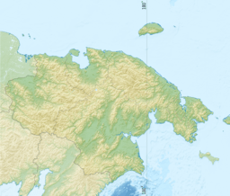
Onemen Bay (which is Онемен in Russian and Онмын in Chukchi) is a large bay located in the far eastern part of Russia. It's a part of the huge Gulf of Anadyr, which connects to the Bering Sea. This area is known for its cold climate and beautiful, wild landscapes. The bay is found in the Chukotka Autonomous Okrug, a region in Russia.
Onemen Bay is quite long, stretching about 40 kilometers (about 25 miles). It's also about 5 kilometers (3 miles) wide. The deepest parts of the bay can reach about 20 meters (65 feet). There aren't many towns right on the bay's shores. The main settlement nearby is Tavayvaam, located at the eastern end of the bay. The larger city of Anadyr is also close by, just past the bay's mouth.
Where is Onemen Bay?
Onemen Bay is situated in a flat area called the Anadyr Lowlands. It's surrounded by interesting waterways. To the west, you'll find the mouth of the mighty Anadyr River. This river is one of the most important in the region.
Connecting Waterways
To the east of Onemen Bay is the Anadyrsky Liman, which is like a large estuary where the river meets the sea. This area is very important for the local ecosystem.
Further north, on the eastern side of the bay, there's a smaller water body called Kanchalan Bay. This is actually an estuary for the Kanchalan River. To the south of Onemen Bay, another river, the Velikaya River, flows into the sea. All these rivers and bays create a complex network of water in this remote part of Russia.
 | Toni Morrison |
 | Barack Obama |
 | Martin Luther King Jr. |
 | Ralph Bunche |


