Ophir, Utah facts for kids
Quick facts for kids
Ophir, Utah
|
|
|---|---|

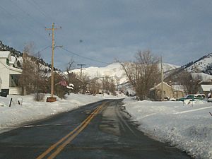
Ophir in winter, December 2007
|
|

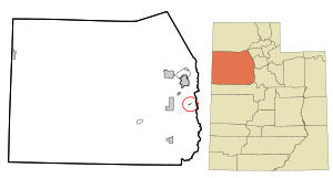
Location in Tooele County and the State of Utah
|
|

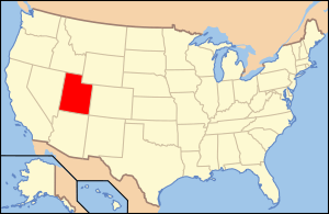
Location of Utah in the United States
|
|
| Country | United States |
| State | Utah |
| County | Tooele |
| Named for | Ophir |
| Area | |
| • Total | 0.2 sq mi (0.4 km2) |
| • Land | 0.2 sq mi (0.4 km2) |
| • Water | 0.0 sq mi (0.0 km2) |
| Elevation | 6,582 ft (2,006 m) |
| Population
(2012)
|
|
| • Total | 40 |
| • Density | 143.0/sq mi (55.2/km2) |
| Time zone | UTC-7 (Mountain (MST)) |
| • Summer (DST) | UTC-6 (MDT) |
| ZIP code |
84071
|
| Area code(s) | 435 |
| FIPS code | 49-56750 |
| GNIS feature ID | 2787910 |
Ophir is a small community located in Tooele County, Utah, in the United States. It is considered part of the larger Salt Lake City area. In 2000, only 23 people lived there.
A Look at Ophir's History
Ophir got its name from a nearby canyon and mining area. In the 1860s, people found valuable metals like gold and silver there. The mining area was named after a place in the Bible called Ophir, known for its gold. Later, in 1911, zinc was also found. Mining continued in Ophir until 1959.
Before 2016, Ophir was one of the smallest towns in Utah with its own local government. However, in 2016, the town decided to stop being an official town. This happened because there were not enough citizens left to form a town government.
Where is Ophir Located?
According to the United States Census Bureau, Ophir covers a total area of 0.2 square miles (0.4 square kilometers). All of this area is land.
Who Lives in Ophir?
| Historical population | |||
|---|---|---|---|
| Census | Pop. | %± | |
| 1890 | 249 | — | |
| 1900 | 295 | 18.5% | |
| 1910 | 283 | −4.1% | |
| 1920 | 522 | 84.5% | |
| 1930 | 170 | −67.4% | |
| 1940 | 300 | 76.5% | |
| 1950 | 199 | −33.7% | |
| 1960 | 36 | −81.9% | |
| 1970 | 76 | 111.1% | |
| 1980 | 42 | −44.7% | |
| 1990 | 25 | −40.5% | |
| 2000 | 23 | −8.0% | |
| 2010 | 38 | 65.2% | |
| 2016 (est.) | 55 | 44.7% | |
| U.S. Decennial Census | |||
In 2000, there were 23 people living in Ophir, making up 10 households and 6 families. The population density was about 143 people per square mile. Most of the people living in Ophir were White (95.65%), with a small percentage being Asian (4.35%).
About 20% of the households had children under 18 living with them. Most households (60%) were married couples. About 40% of households were single people, and 20% of these were people aged 65 or older. The average household had 2.3 people.
The age of people in Ophir varied. About 8.7% were under 18 years old. Another 8.7% were between 18 and 24. A larger group, 43.5%, were between 45 and 64 years old. About 30.4% of the population was 65 or older. The average age in Ophir was 54 years.
See also
 In Spanish: Ophir (Utah) para niños
 | Delilah Pierce |
 | Gordon Parks |
 | Augusta Savage |
 | Charles Ethan Porter |

