Orchard Homes, Montana facts for kids
Quick facts for kids
Orchard Homes, Montana
|
|
|---|---|

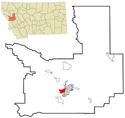
Location in Missoula County and the state of Montana
|
|
| Country | United States |
| State | Montana |
| County | Missoula |
| Area | |
| • Total | 5.88 sq mi (15.23 km2) |
| • Land | 5.62 sq mi (14.56 km2) |
| • Water | 0.26 sq mi (0.68 km2) |
| Elevation | 3,153 ft (961 m) |
| Population
(2020)
|
|
| • Total | 5,377 |
| • Density | 956.76/sq mi (369.41/km2) |
| Time zone | UTC-7 (Mountain (MST)) |
| • Summer (DST) | UTC-6 (MDT) |
| ZIP Code |
59804 (Missoula)
|
| Area code(s) | 406 |
| FIPS code | 30-55675 |
| GNIS feature ID | 0788477 |
Orchard Homes is a special kind of community called a census-designated place (CDP) in Missoula County, Montana, United States. It is part of the larger Missoula metropolitan area. In 2020, about 5,377 people lived there.
Contents
Geography of Orchard Homes
Orchard Homes is located in the middle of Missoula County. It sits right next to the city of Missoula on its eastern side. A major road, U.S. Route 93, runs just east of the community. This road can take you north to Interstate 90 or south to U.S. Route 12. Downtown Missoula is only about 3 miles (5 km) east of Orchard Homes.
This community covers an area of about 5.88 square miles (15.23 square kilometers). Most of this area is land, with a small part, about 0.26 square miles (0.68 square kilometers), being water. The Clark Fork River forms the northern border of Orchard Homes. The Bitterroot River, which flows into the Clark Fork, borders the community to the west and south.
People Living in Orchard Homes
| Historical population | |||
|---|---|---|---|
| Census | Pop. | %± | |
| 1980 | 10,837 | — | |
| 1990 | 10,317 | −4.8% | |
| 2000 | 5,199 | −49.6% | |
| 2010 | 5,197 | 0.0% | |
| 2020 | 5,377 | 3.5% | |
| U.S. Decennial Census | |||
In 2000, there were 5,199 people living in Orchard Homes. These people lived in 2,034 different homes. The population density was about 815 people per square mile (315 people per square kilometer).
Most of the people living in Orchard Homes were White (95.35%). There were also smaller groups of Native American (1.35%) and Asian (1.29%) residents. About 1.35% of the population identified as Hispanic or Latino.
The average age of people in Orchard Homes in 2000 was 40 years old. About 24.2% of the population was under 18 years old. About 12.6% of the people were 65 years old or older.
Education in Orchard Homes
Students in Orchard Homes attend different schools depending on where they live. The community is divided among a few elementary school districts:
- Target Range Elementary School District
- Missoula Elementary School District
- Hellgate Elementary School District (a small part)
However, all students in Orchard Homes attend high school in the Missoula High School District.
See also
 In Spanish: Orchard Homes (Montana) para niños

