Bitterroot River facts for kids
Quick facts for kids Bitterroot River |
|
|---|---|
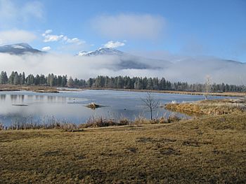
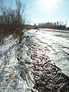
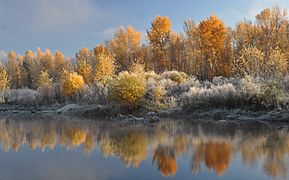
Ice fog hanging over Bitterroot River at Lee Metcalf National Wildlife Refuge
|
|
| Native name | Spet-lum and In-shi-ttogh-tae-tkhu |
| Other name(s) | St. Mary's River |
| Country | United States |
| State | Montana |
| Region | Missoula and Ravalli County, Montana |
| Physical characteristics | |
| Main source | Confluence of 45°56′24″N 114°07′38″W / 45.94000°N 114.12722°W |
| River mouth | Confluence with Clark Fork River Missoula, Montana 3,104 ft (946 m) 46°51′42″N 114°07′09″W / 46.86167°N 114.11917°W |
| Length | 75 mi (121 km), South-north |
| Basin features | |
| River system | Columbia Basin |
| Basin size | 2,814 sq mi (7,290 km2) |
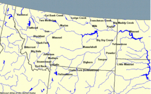
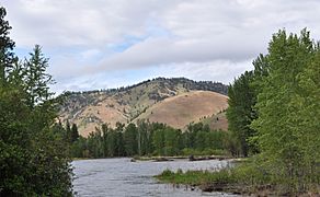
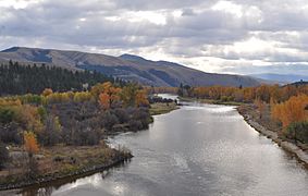
The Bitterroot River is a beautiful river in western Montana, United States. It flows north for about 84 miles (135 km) through the scenic Bitterroot Valley. The river starts where its West and East forks meet near Conner. It then flows into the Clark Fork River near Missoula.
The Clark Fork River eventually joins the Columbia River, which flows all the way to the Pacific Ocean. The Bitterroot River is famous for its excellent fishing, especially for native westslope cutthroat trout and bull trout. It's one of the most popular rivers in Montana for fly fishing.
Contents
History of the Bitterroot River's Name
The Bitterroot River gets its name from a special plant called the bitterroot plant (Lewisia rediviva). This plant has a thick root that was a very important food source for Native American tribes.
Native American Names
The Salish people had two names for the river. They called it Spet-lum, which means "Place of the bitterroot." They also called it In-shi-ttogh-tae-tkhu, meaning "Willow River."
European Names
Early French trappers knew the bitterroot plant as racine amère, which also means "bitter root." A Jesuit priest named Father De Smet later called the river St. Mary's River. By 1853, when Washington Territory was being surveyed by Governor Isaac I. Stevens, the name had been translated to Bitterroot River, and it has been known by that name ever since.
The Bitterroot River Watershed
A watershed is an area of land where all the water drains into a single river or body of water. The Bitterroot River watershed covers about 2,889 square miles (7,482 km²) in Ravalli and Missoula counties.
River Flow and Tributaries
The Bitterroot Valley is quite wide, usually 7 to 10 miles across. The main part of the Bitterroot River starts where the East Fork Bitterroot River and the West Fork Bitterroot River join together. Many smaller streams, called tributaries, flow into the Bitterroot River from the Bitterroot Mountains to the west and the Sapphire Mountains to the east.
The river's water mostly comes from melting snow in the mountains. This means the amount of water in the river changes a lot each year. The highest water levels are usually from mid-May to mid-June. Sometimes, parts of the river can have very low water, especially between Corvallis and Stevensville. This happens because a lot of water is taken out for irrigation (watering crops) and because of water stored in Painted Rocks Reservoir.
Major Tributaries
Two important streams that flow into the Bitterroot River are Skalkaho Creek and Lolo Creek.
- Skalkaho Creek starts in the Sapphire Mountains and flows for about 28 miles (45 km) before joining the Bitterroot River.
- Lolo Creek is a main tributary in the northern part of the watershed. In late summer, the lower part of Lolo Creek can sometimes dry up completely because water is used for irrigation and homes.
Wildlife and Natural Habitat
Even though the Bitterroot River flows near many towns, it's a fantastic place to see wildlife.
Birds and Mammals
You can often spot many kinds of ducks and other waterfowl along the river. Osprey, bald eagles, and heron are also common sights. Larger animals like elk (Cervus canadensis), moose (Alces alces), white-tailed deer (Odocoileus virginianus), and mule deer (Odocoileus hemionus) come to the river to drink and eat near its banks.
A great spot for wildlife viewing is the Lee Metcalf National Wildlife Refuge. This refuge is named after U.S. Senator Lee Metcalf, who was a very important person in protecting nature.
Fish Species
The Bitterroot River is famous for fly fishing. The main river and its smaller streams are important places for native fish to travel and lay their eggs.
- Native Fish: The most important native fish are the westslope cutthroat trout (Oncorhynchus clarki lewisi) and bull trout (Salvelinus confluentus). Other native fish include mountain whitefish (Prosopium williamsoni), longnose sucker (Catostomus catostomus), slimy sculpin (Cottus cognatus), and longnose dace (Rhinichthys cataractae).
- Non-Native Fish: Some fish, like rainbow trout (Oncorhynchus mykiss) and brown trout (Salmo trutta), are popular for fishing but are not originally from the Bitterroot River. These non-native fish can cause problems for the native trout. For example, rainbow trout can breed with cutthroat trout, creating "cutbows," which are a mix of the two. Also, brook trout (Salvelinus fontinalis), another non-native species, can take over the habitats of native cutthroat and bull trout in smaller streams.
Fun and Recreation
The towns along the Bitterroot River, like Hamilton, Stevensville, Missoula, and Darby, are popular places for people who love to fly fish. You can find rainbow trout, brown trout, and westslope cutthroat trout here.
The Bitterroot River is considered a Class I river. This means that from where its East and West forks meet all the way to where it joins the Clark Fork River, the public has access for fun activities like fishing and boating.
In Popular Culture
- The song "Bitterroot" by the Indigo Girls is about this river.
- The Bitterroot River is mentioned a lot in Norman MacLean's famous short novel, "A River Runs Through It".
Gallery
|
 | Delilah Pierce |
 | Gordon Parks |
 | Augusta Savage |
 | Charles Ethan Porter |


