
Darby, Montana facts for kids
Quick facts for kids
Darby, Montana
|
|
|---|---|

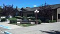
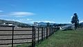
Discovery nature trail (East side towards river)
|
|

Location of Darby, Montana
|
|
| Country | United States |
| State | Montana |
| County | Ravalli |
| Area | |
| • Total | 0.65 sq mi (1.69 km2) |
| • Land | 0.63 sq mi (1.64 km2) |
| • Water | 0.02 sq mi (0.05 km2) |
| Elevation | 3,885 ft (1,184 m) |
| Population
(2020)
|
|
| • Total | 783 |
| • Density | 1,238.92/sq mi (478.32/km2) |
| Time zone | UTC-7 (Mountain (MST)) |
| • Summer (DST) | UTC-6 (MDT) |
| ZIP code |
59829
|
| Area code(s) | 406 |
| FIPS code | 30-19300 |
| GNIS feature ID | 0782081 |
Darby is a small town in Ravalli County, Montana, USA. Its name in the Salish language means "Place Where They Would Lift Something." About 783 people lived there in 2020.
Darby is located close to the border of Montana and Idaho. It's also near the Continental Divide, which is like a big mountain ridge. The town started officially in 1889. It was named after James W. Darby, who helped set up the local post office.
Contents
Exploring Darby's Location and Weather
Darby is found at 46.022030 degrees North and 114.179603 degrees West. The town covers about 0.65 square miles (1.69 square kilometers) of land. There is no water area within the town limits. The area south of Darby is called nɫpapʔá in Salish.
Darby's Climate and Seasons
Darby has a humid continental climate. This means it has big changes in temperature throughout the year. Summers are warm to hot, and sometimes humid. Winters are cold, and can be very cold.
Visitors to Darby should be aware of thunderstorms. Strong lightning strikes have happened in the area. For example, in 2014, a single lightning strike killed 45 cattle on a nearby ranch.
Who Lives in Darby?
Darby's population has grown over the years. In 1920, about 325 people lived there. By 2020, the population had grown to 783 people.
| Historical population | |||
|---|---|---|---|
| Census | Pop. | %± | |
| 1920 | 325 | — | |
| 1930 | 285 | −12.3% | |
| 1940 | 481 | 68.8% | |
| 1950 | 415 | −13.7% | |
| 1960 | 398 | −4.1% | |
| 1970 | 538 | 35.2% | |
| 1980 | 581 | 8.0% | |
| 1990 | 625 | 7.6% | |
| 2000 | 710 | 13.6% | |
| 2010 | 720 | 1.4% | |
| 2020 | 783 | 8.8% | |
| U.S. Decennial Census | |||
Darby's Population in 2010
According to the 2010 census, 720 people lived in Darby. There were 303 households. About 28% of these households had children under 18. The average age of people in Darby was about 40.8 years old. Almost half of the residents were under 45 years old.
Fun Things to Do and See in Darby
Darby has several interesting places and events.
Museums and History
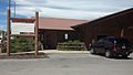
The Darby Pioneer Memorial Museum shows many old items from early settlers. The Darby Ranger Station Museum shares information about the station and its workers. It also acts as a Visitor Center for tourists.
Annual Events and Festivals
Darby hosts several fun events each year:
- In January, the Bitterroot Mushers hold the Darby Dog Derby. This event features exciting dog sled races.
- During summer, "Last Fridays" at Main Street Park offer live music, art, and local vendors.
- In July, the Strawberry Festival raises money for the fire department. You can enjoy strawberry shortcake and live bluegrass music.
- The Hardtimes Bluegrass Festival is held north of town. In 2023, thirteen bands performed there.
- The Darby Rodeo Association puts on several rodeos throughout the year. The Yellowstone Darby Xtreme Bareback Event is a big professional rodeo event.
The Darby Community Public Library serves the town.
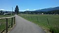
Parks, Recreation, and Outdoor Adventures
Darby has five city parks. It also has a skatepark and a system of trails for walking or biking. The Darby Skatepark was built by a well-known company called Evergreen Skateparks. Several hiking trails start near Darby.
Outdoor Activities Near Darby
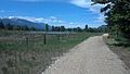
The Bitterroot River runs right next to town. It is very popular for fly fishing. You can fish in both the West Fork and East Fork parts of the river.
Lake Como is only about 7 miles (11 km) away. It's a beautiful lake in the Bitterroot National Forest. Here you can go fishing, kayaking, and hiking. Nearby Painted Rocks State Park has a reservoir where you can go boating and camping.
South of Darby, you'll find Lost Trail Powder Mountain. This is a great place for both downhill skiing and snowboarding in the winter.
Education in Darby
The Darby School District teaches students from kindergarten through 12th grade. There are three schools in the district: an elementary school, a middle school (for grades 7 and 8), and a high school. In 2022, about 349 students attended Darby schools. The sports teams at Darby High School are called the Tigers.
Darby in the Media
The Ravalli Republic newspaper, published in nearby Hamilton, covers news about Darby. The FM radio station KHDV is licensed in Darby. It plays classic hit songs.
TV Shows Filmed in Darby
The popular American TV series Yellowstone is filmed near Darby. The show started in 2018. Many scenes are shot at the Chief Joseph Ranch, which is used as the home of the main character, John Dutton.
Getting Around Darby
US Route 93 is a main road that goes through Darby from north to south. The closest airport for commercial flights is Missoula Montana Airport. It is about 63 miles (101 km) north of Darby.
In 2023, a new health clinic began construction in Darby. Other healthcare facilities are located in Hamilton or Missoula.
Scenic Community Gallery
-
Fishing north of Darby (Lost Horse)
-
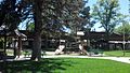
Main street park
-
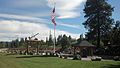
Veterans Memorial at Loggers Day field
-
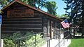
Pioneer Memorial Museum
-
District Library
-
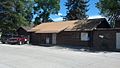
Community clubhouse
-
Discovery nature trail (West side near Rodeo grounds)
-
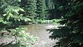
Discovery nature trail (East side towards river)
-
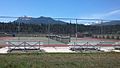
Richard Cromwell Memorial Rodeo Grounds
-
Tennis courts next to school
-
Town Hall (Tanner Ave and Hwy 93)


See also
 In Spanish: Darby (Montana) para niños
