Bitterroot Mountains facts for kids
Quick facts for kids Bitterroot Mountains |
|
|---|---|

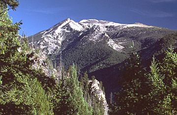
Trapper Peak, in the Central Bitterroot Range
|
|
| Highest point | |
| Peak | Trapper Peak |
| Elevation | 10,157 ft (3,096 m) |
| Dimensions | |
| Area | 4,862 sq mi (12,590 km2) |
| Geography | |
| Country | United States |
| Parent range | Bitterroot Range |
The Bitterroot Mountains are a big part of the Bitterroot Range. They are located in Idaho and Montana in the Western United States. These mountains are also part of the huge Rocky Mountains chain.
The Bitterroot Mountains are made up of two main sections: the Northern Bitterroot Range and the Central Bitterroot Range. Together, they cover a large area of about 4,862 square miles (12,593 km²). The Salish people, who are Native Americans, call these mountains čkʷlkʷqin.
These mountains have natural borders all around them. To the north is Lolo Creek. The Clark Fork River is to the northeast. The Salmon River is to the south. On the east, you'll find the Bitterroot River and its valley. To the west are the Selway River and Lochsa River.
The very highest point in the Bitterroot Mountains is Trapper Peak. It stands tall at 10,157 feet (3,096 meters) above sea level.
Contents
Exploring the Northern Bitterroot Range
| Northern Bitterroot Range | |
|---|---|
| Highest point | |
| Peak | Rhodes Peak |
| Elevation | 7,930 ft (2,420 m) |
| Dimensions | |
| Length | 66 mi (106 km) N/S |
| Width | 88 mi (142 km) E/W |
| Area | 1,869 sq mi (4,840 km2) |
| Geography | |
| Country | United States |
The Northern Bitterroot Range is the part of the Bitterroot Mountains that is furthest north. It is also the shortest section. This area covers about 1,869 square miles (4,841 km²).
The two highest peaks in the Northern Bitterroots are:
- Rhodes Peak, which is 7,930 feet (2,417 m) tall.
- Quartz Benchmark, which reaches 7,770 feet (2,368 m).
What is the Grave Creek Range?
Inside the Northern Bitterroots, there's a smaller group of mountains called the Grave Creek Range. This subrange is about 262 square miles (679 km²) in size. Its highest point is Petty Mountain, standing at 7,270 feet (2,216 m).
Discovering the Central Bitterroot Range
| Central Bitterroot Range | |
|---|---|

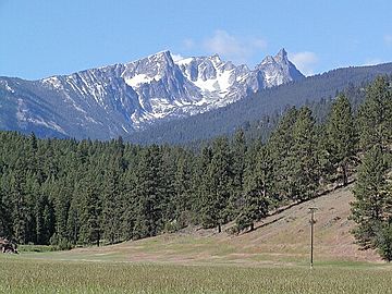
Another view of Trapper Peak, from US 93
|
|
| Highest point | |
| Peak | Trapper Peak |
| Elevation | 10,157 ft (3,096 m) |
| Dimensions | |
| Length | 103 mi (166 km) N/S |
| Width | 48 mi (77 km) E/W |
| Area | 2,993 sq mi (7,750 km2) |
| Geography | |
| Country | United States |
The Central Bitterroot Range is the southernmost and tallest part of the Bitterroot Mountains. It covers a larger area of about 2,993 square miles (7,752 km²).
The two highest peaks in the Central Bitterroots are:
- Trapper Peak, which is the tallest at 10,157 feet (3,096 m).
- El Capitan, which is 9,983 feet (3,043 m) high.
What are the Como Peaks?
The Central Bitterroots also contain a smaller subrange called the Como Peaks. This area is about 79 square miles (205 km²) in size. Its highest peak is El Capitan, which we just mentioned.
Early History of the Bitterroot Mountains
The Bitterroot Mountains were a big surprise for the Lewis and Clark Expedition. This famous journey happened a long time ago. Lewis and Clark were exploring the western parts of North America.
They hoped to find an easy water route from the Atlantic Ocean to the Pacific Ocean. But when they reached the Bitterroot Mountains, they found a very tough obstacle. The mountains were so difficult to cross that they realized there was no easy "Northwest Passage" through them. This changed their plans for the rest of their expedition.
 | Percy Lavon Julian |
 | Katherine Johnson |
 | George Washington Carver |
 | Annie Easley |

