Bitterroot Valley facts for kids

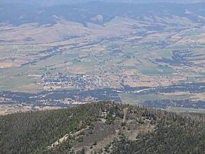
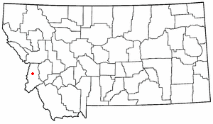
The Bitterroot Valley is a beautiful area in southwestern Montana. It stretches along the Bitterroot River. This valley sits between two mountain ranges: the Bitterroot Range and the Sapphire Mountains. It is part of the Northwestern United States.
Contents
Exploring the Valley's Geography
The Bitterroot Valley is about 95 miles (153 km) long. It starts narrow at Lost Trail Pass in Idaho. Then it gets wider and flatter near the city of Missoula.
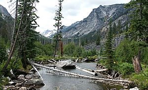
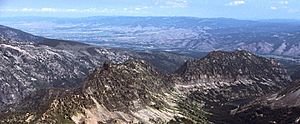
To the west, you'll find the Bitterroot Range. This range has steep sides and deep canyons. It is covered in thick forests and is part of the Bitterroot National Forest. It also includes a huge wild area called the Selway-Bitterroot Wilderness.
To the east are the smaller Sapphire Mountains. These mountains are more rounded and drier. They have fewer trees. They also contain the Anaconda-Pintler Wilderness.
The southern part of the valley splits into two branches of the Bitterroot River. At the northern end, the Bitterroot River joins the Clark Fork River. This meeting point is called a confluence. Many deep, rocky canyons connect to the west side of the valley. These include the scenic Blodgett Canyon and Lolo Creek's canyon.
Long ago, the valley was covered in sagebrush. Over time, the plants in the valley have changed a lot.
Highway 93 runs right through the middle of the valley. To the south, it crosses Lost Trail Pass, which is over 7,014 feet (2,138 m) high. Highway 93 is the main road. But the East Side Highway also goes through the valley and is much quieter.
Towns and Communities
Many towns are found within the Bitterroot Valley. These include Lolo in Missoula County. In Ravalli County, you'll find Florence, Stevensville, Victor, Corvallis, Hamilton, Darby, Conner, and Sula.
Hamilton is the biggest town in the valley. It is also the main town for Ravalli County. About 12,000 people live there. It sits at an elevation of 3,570 feet (1,088 m). In these towns, people work in many areas. These include making things, farming, brewing craft beers, making wine, and offering fun outdoor activities. Many people also start their own businesses.
A Look Back at History
The Bitterroot Valley was the original home of the Bitterroot Salish tribe. They are part of the Flathead Nation.
In 1805, the Lewis and Clark Expedition traveled through this area. They crossed Lost Trail Pass from Idaho. They followed the Bitterroot River north. They camped at a spot they named Traveler's Rest. This was before they continued their difficult journey west. The next year, they returned to this spot. They then split up to explore more of the region.
In 1841, Jesuit priests started St. Mary's Mission near what is now Stevensville. This was the first lasting settlement by white people in Montana. Later, Fort Owen was built nearby in 1850. There were challenges between the white settlers and the Salish people. In 1891, the native tribes were moved to the Flathead Indian Reservation. In 1877, Chief Joseph and the Nez Perce tribe passed through the valley. They were trying to escape the U.S. Army. They left the valley near where they fought the Battle of the Big Hole.
In the early 1900s, the Bitterroot Valley was famous for its apples. It had almost a million apple trees! It was one of the world's biggest producers of MacIntosh apples. About 80 miles (129 km) of canals helped water the trees. After big hailstorms in 1922 and 1923, the apple farms faced tough times. They could not compete as well with apple farms in Washington state. But the valley is still home to one of the largest cider orchards in the country.
More people have moved to the valley since then. In 2000, Ravalli County had 36,070 people. By 2010, it had grown to 40,212 people. Today, the main ways people make a living are ranching, farming, forestry (working with forests), and tourism.

Fun Things to Do in the Valley
The Bitterroot Valley offers many exciting activities. You can go hiking, backpacking, or mountain biking in the mountains. Rock climbing is also popular. Along the Bitterroot River, you can enjoy bird watching and fishing. The valley is also a favorite spot for hunters. They hunt for big game, birds, and waterfowl.
Bitterroot Valley in Popular Culture
The Bitterroot Valley is mentioned in a song called "Wild Montana Skies." This song is from John Denver's album It's About Time, released in 1983.
 | Jewel Prestage |
 | Ella Baker |
 | Fannie Lou Hamer |


