Hail facts for kids
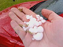
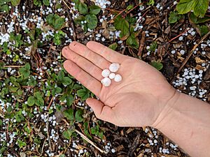
Hail is a type of solid precipitation that falls from the sky. It's made of balls or irregular lumps of ice, and each piece is called a hailstone. Hail is different from ice pellets (also called sleet), which are smaller and usually fall in colder weather.
Hailstones are typically larger than other icy precipitation like snow or graupel. They usually measure between 5 millimeters (0.2 inches) and 15 centimeters (6 inches) across. When weather reports mention hail, "GR" means hailstones are 5 mm (0.2 in) or larger, while "GS" is used for smaller hailstones or graupel.
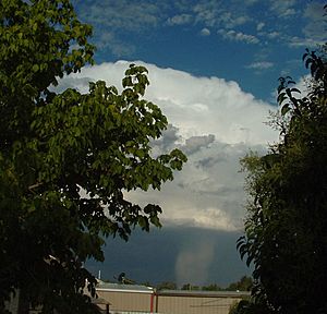
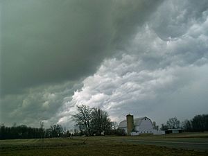
Hail forms inside strong thunderstorm clouds, especially cumulonimbus clouds. For hail to form, there needs to be powerful upward-moving air currents (called updrafts) within the storm. These updrafts keep the ice growing higher in the cloud. Hail is more common in the middle parts of continents, but in tropical areas, it usually happens at high elevations like mountains.
Scientists use weather satellites and weather radar to find thunderstorms that might produce hail. Larger hailstones generally fall faster, but things like melting, air friction, and wind can slow them down. Weather warnings are issued when hailstones are big enough to cause damage, as they can harm buildings, cars, and especially farmers' crops.
Contents
What is Hail?
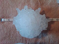
Any thunderstorm that produces hail reaching the ground is called a hailstorm. An ice crystal is considered a hailstone if it's larger than 5 millimeters (0.2 inches) in diameter. Some hailstones can grow very large, up to 15 centimeters (6 inches) across, and weigh more than 0.5 kilograms (1.1 pounds)!
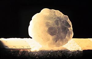
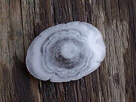
Unlike ice pellets, hailstones often have layers, like an onion. They can be clear or have alternating layers of clear and cloudy ice. These layers form as the hailstone travels through the cloud, held up by strong updrafts. It keeps growing until it gets too heavy for the updraft and falls to the ground. In the United States, damaging hail is often the size of a golf ball (about 4.4 centimeters or 1.75 inches).
Hailstones larger than 2 centimeters (0.8 inches) are usually big enough to cause damage. Different countries have different rules for when they issue warnings. For example, areas that grow grapes might be affected by smaller hailstones. The size of hailstones depends on how strong the updraft is; stronger storms can hold larger hailstones up for longer, allowing them to grow bigger.
How Hail Forms
Hail forms in powerful thunderstorm clouds. These clouds have strong updrafts, lots of water, and a large part of the cloud is below freezing (0 degrees Celsius or 32 degrees Fahrenheit). These strong updrafts can also be a sign that a tornado might form.
The Layers of a Hailstone
Hail starts as tiny water droplets in the cloud. As these droplets rise higher, the temperature drops below freezing. They become "supercooled" water, meaning they are still liquid even below freezing. When they touch a tiny particle (a condensation nuclei), they freeze.
If you cut a large hailstone in half, you might see layers, like an onion. For a long time, people thought this meant hailstones went up and down many times in the cloud, adding a new layer each time. However, new research shows this isn't always true.
The storm's powerful updraft, with winds sometimes as fast as 110 miles per hour (177 km/h), pushes the forming hailstones up into the cloud. As a hailstone moves up, it passes through different parts of the cloud. Some areas have lots of water droplets, and others have more water vapor.
- When the hailstone enters an area with many water droplets, it collects them and forms a clear, thick layer.
- If it moves into an area with mostly water vapor, it forms a cloudy, white layer.
The hailstone's speed also changes depending on where it is in the updraft and how heavy it is. This affects how thick each layer becomes. Larger hailstones tend to form a bit away from the strongest part of the updraft, where they can spend more time growing. As a hailstone grows, it releases heat, which keeps its outside surface a bit wet and sticky. This allows it to collide with and absorb smaller hailstones, growing even larger and sometimes forming irregular shapes. This is called "wet growth."
Hail can also grow in a "dry growth" way. This happens when the outside of the hailstone freezes too quickly to stay liquid. Hail formed this way looks cloudy because tiny air bubbles get trapped inside. These bubbles usually escape during "wet growth," making the hailstone clearer. A hailstone can switch between wet and dry growth, which is why it has distinct layers.
The hailstone keeps rising until it's too heavy for the updraft to hold it up. This can take at least 30 minutes in a strong thunderstorm, which can reach over 10 kilometers (6 miles) high. Then, it falls towards the ground, still growing as it leaves the cloud. It starts to melt as it falls into warmer air closer to the ground.
So, a single journey through the storm can explain the layered look of a hailstone. Only in very rare cases, like in a multi-cell thunderstorm, might a hailstone be caught by another updraft.
Where Hail is Most Common
Hail is most common in the middle parts of continents, away from the coasts. This is because hail forms more easily when the freezing level in the atmosphere is lower, below about 11,000 feet (3,350 meters). Dry air moving into strong thunderstorms over land can make hail more likely. This dry air causes cooling, which lowers the freezing level, giving hail more space to grow.
Because of this, hail is less common in tropical areas, even though they have many thunderstorms. The air in the tropics is usually warmer at higher altitudes. In tropical regions, hail mainly occurs at higher elevations, like in mountains.
Hail growth slows down a lot when air temperatures drop below -30 degrees Celsius (-22 degrees Fahrenheit), as there are fewer supercooled water droplets at these very cold temperatures.
Where Hail Happens Around the World
Hail happens most often in the middle latitudes, inside continents. It's less common in tropical areas, even though tropical regions have more thunderstorms. Hail is also much more common near mountain ranges. Mountains force winds upwards (this is called orographic lifting), which makes the updrafts in thunderstorms stronger and increases the chance of hail. Also, at higher elevations, hail has less time to melt before it hits the ground.
One area famous for large hail is northern India, which had a very deadly hailstorm in 1888. China, Central Europe, and southern Australia also experience many hailstorms. In Europe, places like southern and western Germany, northern and eastern France, and northern Italy often get hail.
In North America, hail is very common where Colorado, Nebraska, and Wyoming meet. This area is even called "Hail Alley." Hailstorms here usually happen between March and October, mostly in the afternoon and evening. Cheyenne, Wyoming gets more hailstorms than any other city in North America, with about nine to ten per season. Another "Hailstorm Alley" is in Alberta, Canada, just downwind of the Rocky Mountains.
Detecting Hailstorms
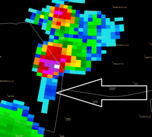
Weather radar is a very useful tool for finding thunderstorms that produce hail. However, meteorologists also need to know about the current weather conditions to predict if hail will form.
Modern radar systems scan the sky from many angles. The radar signals show how much precipitation is in different parts of the storm. By adding up these signals, scientists can estimate the amount of liquid water inside the cloud. This helps them understand if hail is developing high up in the storm.
Radar can also show certain patterns that are clues for meteorologists. One example is the "three-body scatter spike." This happens when radar energy hits hail, bounces to the ground, then bounces back to the hail, and finally returns to the radar. This extra bouncing takes more time, so the radar shows a faint "spike" behind the actual location of the hail.
More recently, advanced radar systems can tell the difference between hail and heavy rain by looking at the shape of the radar signals. Scientists are also trying to use satellite images to detect hail, but this method can sometimes give false alarms.
How Big is Hail and How Fast Does it Fall?
The best way to measure a hailstone is with a ruler. If you don't have one, people often compare hailstones to everyday objects like coins. However, comparing them to things like eggs or marbles can be tricky because those objects come in different sizes.
At airports, special codes are used in weather reports to describe hail size. "GR" means large hail (at least 0.25 inches or 6.4 mm in diameter). "GS" is for smaller hail or snow pellets.
The speed at which hail falls to the ground, called its terminal velocity, changes. A hailstone about 1 centimeter (0.4 inches) across falls at about 9 meters per second (20 mph). A very large hailstone, 8 centimeters (3.1 inches) across, can fall at about 48 meters per second (107 mph)! The speed depends on the hailstone's size, shape, the wind, and if it melts as it falls. Since hailstones aren't perfectly round, it's hard to calculate their exact speed.
Comparing Hail Size to Everyday Objects
In the United States, the National Weather Service often describes hail size by comparing it to common objects. Hailstones larger than 1 inch (2.5 cm) are considered "severe."
| Diameter (inches) | Everyday Object |
|---|---|
| 0.25 - 0.375 | Pea |
| 0.50 | Small Marble |
| 0.75 | Penny |
| 0.88 | Nickel |
| 1.00 (15/16") | Quarter |
| 1.25 | Half Dollar |
| 1.50 | Walnut/Ping Pong Ball |
| 1.75 | Golf Ball |
| 2.00 | Lime |
| 2.50 | Tennis Ball |
| 2.75 | Baseball |
| 3.00 | Large Apple |
| 4.00 | Softball |
| 4.50 | Grapefruit |
| 4.75 - 5.00 | Computer CD/DVD |
Hail Records
- Heaviest: 1.02 kilograms (2.25 pounds); Gopalganj District, Bangladesh, April 14, 1986.
- Largest diameter officially measured: 7.9 inches (20 cm) across, with a circumference of 18.622 inches (47.30 cm); Vivian, South Dakota, July 23, 2010.
- Largest circumference officially measured: 18.74 inches (47.6 cm) around, with a diameter of 7.0 inches (17.8 cm); Aurora, Nebraska, June 22, 2003.
- Most frequent hail: Kericho, Kenya, experiences hailstorms about 50 days a year on average. It once had 132 days of hail in one year! Kericho is near the equator, but its high elevation of 7,200 feet (2,200 meters) makes it a hot spot for hail.
Dangers of Hail
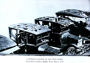
Hail can cause serious damage. It can dent cars, crack or shatter windshields and windows, and damage aircraft. Skylights and glass roofs are also at risk. Hail damage to roofs can be hard to spot at first, but it can lead to leaks and other problems later. Metal roofs are quite strong against hail, but they can still get dents.
Hail is one of the biggest dangers from thunderstorms for airplanes. If hailstones are larger than 0.5 inches (1.3 cm), they can seriously damage a plane in just a few seconds. Hail on the ground can also make it dangerous for planes to land.
Farmers' crops are very sensitive to hail damage. Wheat, corn, soybeans, and tobacco are some of the most affected crops. Hail is one of Canada's most expensive natural hazards.
Very rarely, huge hailstones have caused serious head injuries or even deaths. One of the oldest known incidents happened around the 9th century in Roopkund, India. Hundreds of nomads may have died from injuries caused by hailstones the size of cricket balls.
When Hail Piles Up
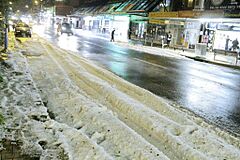
Sometimes, hail falls so heavily that it piles up on the ground in narrow strips called hail streaks or hail swaths. These can even be seen by satellites after the storm passes. Hailstorms usually last from a few minutes up to 15 minutes. When hail piles up, it can be more than 2 inches (5 cm) deep, cause power outages, and knock down trees. In hilly areas, lots of accumulated hail can also lead to flash flooding and mudslides.
Depths of up to 18 inches (46 cm) of hail have been reported! A landscape covered in hail looks a lot like one covered in snow. A lot of hail can block roads and cause problems for transportation, just like snow. Accumulated hail can also block drains, leading to flooding. The hail can then be carried by floodwater, turning into a slushy mix that gets deposited in lower areas.
Sometimes, a thunderstorm stays in one place and produces a huge amount of hail. This often happens in mountainous areas. For example, on July 29, 2010, a foot (30 cm) of hail piled up in Boulder County, Colorado. On June 5, 2015, hail piled up to four feet (1.2 meters) deep on one city block in Denver, Colorado! The hailstones were described as being between the size of bumble bees and ping pong balls. This hail fell for an hour and a half, but only in that one small area. Tractors were needed to clear the area, filling more than 30 dump trucks with hail.
Scientists are studying these extreme hail events to try and predict them. One challenge is that the depth of hail isn't usually reported, unlike hailstone diameter. A project between the University of Colorado and the National Weather Service is asking the public to help collect data on hail accumulation depths.
Trying to Stop Hail
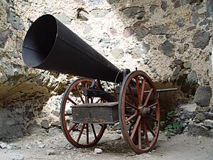
In the Middle Ages, people in Europe would ring church bells and fire cannons to try and prevent hail and protect their crops. Modern versions of this idea exist today, called hail cannons.
After World War II, some countries, especially the Soviet Union, tried "Cloud seeding" to stop hail. They claimed to reduce crop damage by 70–98% by shooting silver iodide into clouds using rockets and artillery shells. However, these results haven't been proven in other scientific tests. Between 1965 and 2005, 15 countries tried hail suppression programs.
|
See also
 In Spanish: Granizo para niños


