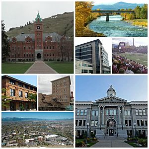
Missoula metropolitan area facts for kids
Quick facts for kids
Missoula Metropolitan Area
|
|
|---|---|
| Missoula, MT Metropolitan Statistical Area | |

Missoula and Surrounding Area
|
|
| Country | |
| State | |
| Principal City | Missoula |
| Time zone | UTC-7 (MST) |
| • Summer (DST) | UTC-6 (MDT) |
The Missoula metropolitan statistical area is a big area in west-central Montana. It includes the city of Missoula and the surrounding communities. This area is often called the Missoula MSA for short.
In 2020, about 122,458 people lived here. This made it the second largest metropolitan area in Montana. By July 2023, the population grew to an estimated 126,939 people. Missoula is now the second metropolitan area in Montana to have over 100,000 residents. The first was Billings.
The Missoula metropolitan area is the largest of its kind between Boise, Idaho, and Calgary, Alberta, Canada. It's also the biggest between Coeur d'Alene, Idaho, and Billings, Montana.
Contents
Counties in the Missoula Area
The Missoula metropolitan area includes one main county:
Communities and Towns
This area has several cities and towns. They range from large cities to smaller villages and even historic "ghost towns."
Main City
- Missoula (This is the largest and most important city in the area.)
Larger Towns (1,000 to 10,000 people)
These places are called "Census-designated places." This means they are areas identified by the Census Bureau for statistics.
Smaller Towns (500 to 1,000 people)
These are also Census-designated places.
Unincorporated Places
These are communities that are not officially part of a city or town.
Historic Ghost Towns
These are places where people used to live, but now they are mostly empty.
- Hell Gate
- Garnet
People and Population
The Missoula metropolitan area is home to many different people. In 2010, there were about 109,299 people living here.
Most people in the area are white (about 92.7%). There are also many people who are American Indian (2.6%) and Asian (1.1%). About 2.6% of the population has Hispanic or Latino roots. Many families have German, Irish, or English backgrounds.
The average age of people in the area was about 34.3 years old in 2010. About 26.5% of households had children under 18 living with them.
How the Population Has Grown
The table below shows how the number of people living in the Missoula area has changed over many years. You can see how much it has grown!
| Census | Population | Change |
|---|---|---|
| 1870 | 2,554 | - |
| 1880 | 2,537 | -0.7% |
| 1890 | 14,427 | 468.7% |
| 1900 | 13,964 | −3.2% |
| 1910 | 23,596 | 69.0% |
| 1920 | 24,041 | 1.9% |
| 1930 | 21,782 | −9.4% |
| 1940 | 29,038 | 33.3% |
| 1950 | 35,493 | 22.2% |
| 1960 | 44,663 | 25.8% |
| 1970 | 58,263 | 30.5% |
| 1980 | 76,016 | 30.5% |
| 1990 | 78,687 | 3.5% |
| 2000 | 95,802 | 21.8% |
| 2010 | 109,299 | 14.1% |
| 2020 | 122,458 | 12.0% |
See also
 In Spanish: Área metropolitana de Missoula para niños
 | James Van Der Zee |
 | Alma Thomas |
 | Ellis Wilson |
 | Margaret Taylor-Burroughs |

