Ord of Caithness facts for kids
Quick facts for kids Ord of Caithness |
|
|---|---|

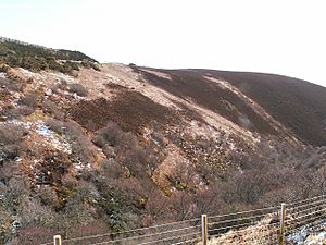
The Ord, seen from the west, from the A9 road on the other side of Ord Burn
|
|
| OS grid | ND056178 |
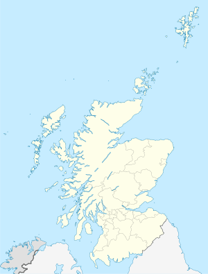
| Coordinates | 58°8′22″N 3°36′15″W / 58.13944°N 3.60417°W |
| Elevation | 198 metres (650 ft) |
| Geology | Granite |
The Ord of Caithness is a large, rocky area made of granite. It sits on the east coast of Scotland, in the Highland region. This impressive landform marks the border between the old counties of Sutherland and Caithness.
The Ord is about 2 kilometers (1.2 miles) northeast of a town called Helmsdale. It forms a high point, or headland, that sticks out into the sea. This headland is known as Ord Point and reaches about 198 meters (650 feet) high. The main road, the A9, travels over the Ord. It has many sharp turns as it winds around the hills.
The Ord's Past: A Tough Journey
For a long time, the Ord of Caithness was a huge challenge for travelers. It was like a natural wall that made it hard to get into Caithness. People who traveled this way were very impressed by how difficult it was.
In the 1880s, people described the old road over the Ord. It used to go along the very edge of steep cliffs overlooking the sea. This path was scary for both people and animals. Even the newer road, built in 1811, had very steep parts. It was still a tough climb for anyone passing through.
 | Calvin Brent |
 | Walter T. Bailey |
 | Martha Cassell Thompson |
 | Alberta Jeannette Cassell |


