Caithness facts for kids
Quick facts for kids
Caithness
|
||
|---|---|---|
|
||
 |
||
| Sovereign state | ||
| Country | ||
| Council area | Highland | |
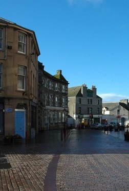
| County town | Wick | |
| Area | ||
| • Total | 618 sq mi (1,601 km2) | |
| Ranked 14th of 34 | ||
| Demonym(s) | Caithnesian | |
| Chapman code |
CAI
|
|
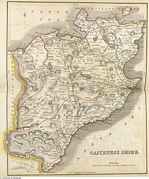
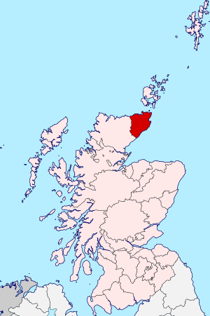
Caithness is a historic area in Scotland. It's also known as a registration county and a lieutenancy area. In Scottish Gaelic, it's called Scottish Gaelic: Gallaibh, which means "among the strangers."
Caithness shares a land border with Sutherland to the west. All other sides are surrounded by the sea. Two main roads, the A9 and the A836, and one railway line, the Far North Line, cross this border.
Across the Pentland Firth, which is a strait of water, you can take ferries to the Orkney Islands. Caithness also has an airport in Wick. The island of Stroma in the Pentland Firth is part of Caithness.
The name Caithness was also used for the earldom of Caithness and for a special voting area in the Parliament of the United Kingdom. Today, the entire area of Caithness is part of the Highland council area.
Contents
What Does "Caithness" Mean?
The name Caithness comes from two parts. The first part, Caith, comes from an ancient Pictish tribe called the Cat or Catti people. The second part, -ness, comes from Old Norse and means "headland" or a piece of land sticking out into the sea.
So, the Norse people called this area Katanes, meaning "headland of the Catt people." Over time, this became Caithness.
The Scottish Gaelic name for Caithness, Gallaibh, means "among the strangers." This refers to the Norse people who settled there. The name of the Catti tribe can still be seen in the Gaelic name for eastern Sutherland, Cataibh, and in the old Gaelic name for Shetland, {{lang|gd|Innse Chat]].
Exploring the Geography of Caithness
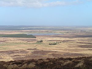
Caithness is about 30 miles (48 km) from north to south and 30 miles (48 km) from east to west. It has a roughly triangular shape and covers about 712 square miles (1,844 km²). Unlike most of northern Scotland, Caithness is generally flat. For a long time, it had very few trees, which made its flat landscape even more noticeable.
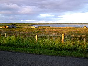
This area is known for its open, rolling farmland, moorland, and scattered villages. The northern and eastern coasts have amazing scenery and are home to large, important groups of seabirds. The waters around Caithness, like the Pentland Firth and the North Sea, are full of diverse marine life.
- North Coast Highlights:
- Sandside Bay
- Thurso Bay
- Dunnet Bay
- Dunnet Head (the northernmost point of mainland Britain)
- Duncansby Head (the north-east tip of mainland Britain)
- East Coast Highlights:
- Freswick Bay
- Sinclairs Bay
- Wick Bay
Stroma is the only major island in Caithness. Away from the coast, the landscape is mostly open moorland and blanket bog, known as the Flow Country. This is the largest area of blanket bog in Europe and stretches into Sutherland. This boggy land is broken up by more fertile farm and croft land along the straths (river valleys). In the far south, the land becomes slightly hillier, with Morven being the highest peak at 706 meters (2,316 ft).
Caithness has many lochs (lakes), though they are smaller than those in other parts of northern Scotland. Some of the notable ones include Loch Watten, Loch Calder, and Loch Shurrery.
The ground beneath most of Caithness is made of Old Red Sandstone, which is estimated to be over 4,000 meters (13,000 ft) deep. This sandstone formed from sediments of a huge ancient lake called Lake Orcadie, which existed about 370 million years ago. You can find fossilized fish and plant remains between the layers of rock. Older, harder rocks are found in the Scaraben and Ord area, in the higher southwest part of the county, where Morven is located.
Because this sandstone easily splits into large flat slabs (flagstone), it's a very useful building material. People have used it for construction since ancient times.
Amazing Natural Heritage
Caithness is a special place for studying nature. It's one of the Watsonian vice-counties, which are areas used by scientists to record plants and animals. This system helps compare nature data from the past with today, even if local government areas have changed.
The unique geology, tough weather, and long history of human activity have shaped the natural environment of Caithness. Today, it has a mix of common and rare habitats and species. Caithness is a safe haven for many birds and animals that have become rare elsewhere, like waders (birds that wade in water), water voles, and large groups of overwintering birds.
Many rare mammals, birds, and fish have been seen in the waters around Caithness. You can often spot Harbour porpoises, different types of dolphins (like Risso's and bottle-nosed), and minke whales from the shore or boats. Both grey and common seals come close to the coast to eat, rest, and raise their young. A large group of seals spends the winter on small islands in the Thurso river, close to the town center. Otters can also be seen near river mouths in quieter spots.
A large part of central Caithness is called the Flow Country. This is a vast area of peatland and wetland, making it the largest blanket bog in Europe. About 1,500 square kilometers (580 sq mi) of the Flow Country is protected as a Special Protection Area (SPA) and Special Area of Conservation (SAC) under the name Caithness and Sutherland Peatlands. Part of it is also a national nature reserve.
In 2014, a section of the eastern coastline of Caithness, between Helmsdale and Wick, was named a Nature Conservation Marine Protected Area. This area, called the East Caithness Cliffs, is also protected for its special birds and habitats.
A Look at Early History
The landscape of Caithness is full of signs of people living there long ago. These include ancient burial sites like the Grey Cairns of Camster, standing stones like the The Stone Lud, and the Hill O Many Stanes. There are also many brochs, which are ancient stone towers.
When the Norsemen (Vikings) arrived, probably around the 900s, the area was home to the Picts. The Picts had their own culture, but it was also influenced by the Celtic Church. The name Pentland Firth might mean "Pictland Fjord," showing the connection to the Picts.
Many groups of Norse settlers landed in Caithness and slowly established themselves along the coast. They gave many places Norse names. Some Caithness family names, like Gunn, also come from Norse origins.
For a long time, both Scotland and the Norwegian Earldom of Orkney claimed Caithness. Around 1196, a Norse Earl named Harald Maddadsson agreed to pay money to William I of Scotland for Caithness. Norway officially recognized Caithness as part of Scotland after the Treaty of Perth in 1266.
Today, groups like Yarrows Heritage Trust and the Caithness Broch Project help us learn more about the ancient history of Caithness.
How Caithness Was Governed
From Shires to Councils
Caithness was once part of a larger area called Inverness. But over time, it slowly became more independent. In 1455, the Earl of Caithness was given the power to act as a judge and sheriff for the area. In 1503, a special law made Caithness a separate legal area. Wick was named the main town where the sheriff would hold courts.
By 1841, the population of Caithness had grown to 36,343 people.
In 1890, Caithness got its own elected county council to manage local affairs. The towns of Wick and Thurso already had their own councils and remained independent. Wick, a royal burgh, became the main administrative center for the county. The county council was located in the County Offices in Wick.
In 1975, big changes happened in local government. Caithness became one of eight districts within a new larger area called the Highland region. This meant the old county council and the town councils of Wick and Thurso were replaced. Wick continued to be the administrative center for the Caithness district.
Modern Local Government (1996-Today)
In 1996, local government in Scotland changed again. The Highland region became a single, large council area called the Highland Council. The smaller district councils, like Caithness, were no longer separate. Their jobs were taken over by the Highland Council.
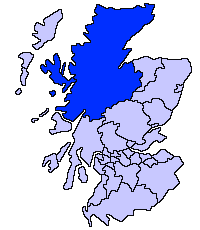
The Highland Council then divided its large area into smaller "management areas" and "committee areas" to help manage things. Caithness was one of these areas.
Since 2007, the Highland Council is the main local government for Caithness. The area is now divided into three new voting areas, or "wards," for electing councillors. These wards are:
- Landward Caithness
- Thurso
- Wick
In 2017, these three wards were changed into two larger "Town and County" wards:
- Thurso and Northwest Caithness
- Wick and East Caithness
These new wards each elect four councillors to the Highland Council.
Local Parishes
Historically, Caithness was divided into civil parishes, which were also church parishes. These parishes are still used for some statistics, like census figures, which helps compare population changes over a long time.
Here are some of the civil parishes in Caithness:
- Bower: Known for the Stone Lud nearby.
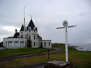
- Canisbay: Includes the famous village of John o' Groats and the Island of Stroma.
- Dunnet: Includes the village of Dunnet and Dunnet Head.
- Halkirk: Includes the village of Halkirk.
- Latheron: Includes the villages of Latheron, Lybster and Dunbeath.
- Olrig: Includes the village of Castletown.
- Reay: Includes the village of Reay. It used to be partly in Sutherland.
- Thurso Landward: The rural area around the town of Thurso.
- Watten: Includes the village of Watten.
- Wick Landward: The rural area around the town of Wick.
Community Councils
Even though they don't have official government powers, community councils are important local groups. They represent local people and help share their views with the Highland Council. The area of Caithness is covered by 12 community councils, each representing a specific local area.
Voting for Parliament
Caithness has been represented in the Parliament of the United Kingdom for a long time. From 1708 to 1918, the Caithness constituency represented the county. The town of Wick also had its own representation as part of other voting areas.
In 1918, Caithness and Wick were combined into a new voting area called Caithness and Sutherland. Then, in 1997, it became part of Caithness, Sutherland and Easter Ross.
For the Scottish Parliament, a similar voting area called Caithness, Sutherland and Easter Ross was created in 1999. In 2011, this was replaced by the larger Caithness, Sutherland and Ross.
These modern voting areas are more about dividing the larger Highland area than strictly following old county lines. Caithness is also part of the Highlands and Islands electoral region in the Scottish Parliament.
Towns and Villages of Caithness
In 2011, Caithness had a population of 26,486 people.
There are two main towns in Caithness:
There are also several villages that have useful services like shops, cafes, or post offices. These include:
- Castletown
- Dunbeath
- Dunnet
- Halkirk
- John o' Groats
- Keiss
- Lybster
- Reay/New Reay
- Scrabster
- Watten
Many other smaller settlements are scattered across Caithness, such as Berriedale, Bower, Canisbay, Clyth, Freswick, Haster, Latheron, Mey, Murkle, Papigoe, Sarclet, Spittal, and Thrumster.
Getting Around: Transport in Caithness
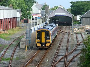
Caithness is served by the Far North railway line. This line runs across the middle of the county, with stations at Altnabreac and Scotscalder. At Georgemas Junction, the line splits. One branch goes east to Wick, and the other goes north to Thurso, which is the northernmost train station in the UK.
Buses provided by Stagecoach Group connect the major towns and travel further south to Inverness.
- Ferry Services:
- The port at Scrabster has regular ferries to Stromness in the Orkney Islands.
- Ferries also run from Gills Bay to St Margaret's Hope on South Ronaldsay.
- During summer, a ferry runs from John o' Groats to Burwick on South Ronaldsay.
Wick Airport used to have regular flights to Aberdeen and Edinburgh. After a break in 2020, Eastern Airways restarted flights to Aberdeen in April 2022.
Languages Spoken in Caithness
When history was first recorded, Caithness was home to the Picts, who spoke a language related to the Brythonic languages of southern Britain. Later, the Norn language was brought to Caithness by the Norse people who arrived around 800 AD. While we don't know much about this Norn dialect, its influence can still be seen in many place names. Norn was spoken in Caithness until about the 1400s and lasted even longer in the Northern Isles.
Some people mistakenly think that Scottish Gaelic was never spoken in Caithness. However, over the centuries, other languages like Scots and later Scottish English became more common. The Gaelic name for the region, Gallaibh, meaning "Land of the Gall (non-Gaels)," shows the historical Norse influence. Gaelic speakers actually became more common from the 1100s onwards, and Gaelic has survived in a limited way in the western parts of the county.
The Scots language began to replace Norn in the early 1300s. The local Northern Scots dialect was influenced by both Gaelic and Norn. It is generally spoken in the low-lying areas east of a line from Clyth Ness to about 4 miles (6.4 km) west of Thurso. The Scots dialect near John o' Groats is similar to the dialect spoken in Orkney. Since the 1600s, Standard Scottish English has increasingly replaced both Gaelic and Scots.
Records from 1706 show that in Caithness, people on the east side of a line from Wick to Thurso mostly spoke English, while those on the west side mostly spoke "Irish" (Gaelic). Seven out of ten or eleven parishes in Caithness used the Gaelic language at that time.
According to the 2011 Scotland Census, 282 residents of Caithness (about 1.1%) aged three and over can speak Gaelic. This percentage is similar to the rest of Scotland. Nearly half of all Gaelic speakers in Caithness live in the Thurso civil parish. The town of Thurso has the only Gaelic-medium primary school unit in Caithness.
The Highland Council's policy of using bilingual English-Gaelic road signs has caused some debate in the region. In 2008, some Caithness councillors tried to stop these signs from being put up. The first bilingual sign in Caithness was put up in 2012. In 2013, a bilingual road sign near Wick Airport was damaged by gunfire shortly after it was placed.
Local News and Radio
Newspapers
The John O'Groat Journal and The Caithness Courier are weekly newspapers. They are published by North of Scotland Newspapers and have offices in Wick and Thurso.
These newspapers focus on news from the former counties of Caithness and Sutherland. The John O'Groat Journal is usually published on Fridays, and The Caithness Courier on Wednesdays. They share a website. Historically, the Groat focused on Wick, and the Courier on Thurso.
Radio
Caithness FM has been broadcasting since 1993, providing local radio for the area.
See also
 | Emma Amos |
 | Edward Mitchell Bannister |
 | Larry D. Alexander |
 | Ernie Barnes |


