Sinclairs Bay facts for kids
Quick facts for kids Sinclair's Bay |
|
|---|---|

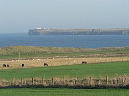
Noss Head, lighthouse from across Sinclair's Bay
|
|
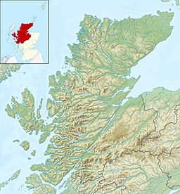
| Location | Caithness, Scotland |
| Coordinates | 58°30′20.5848″N 3°05′38.7960″W / 58.505718000°N 3.094110000°W |
| River sources | River of Wester |
| Ocean/sea sources | North Sea |
| Basin countries | Scotland |
| Max. length | 9.45 km (5.87 mi) |
| Max. width | 3.51 km (2.18 mi) |
| Average depth | 16.2 metres (53 ft) |
Sinclair's Bay is a large bay on the east coast of Scotland. It is located in Caithness, which is part of the Scottish Highlands. The entire coastline of the bay is within the Highland region of Scotland.
Exploring Sinclair's Bay Geography
Sinclair's Bay has a long, curved shape. It stretches from Ness Head in the north, near Freswick Bay. From there, it curves south and then east. The bay ends at Noss Head Lighthouse. You can also see the old Castle Sinclair nearby.
What Makes Up the Coastline?
The coastline of Sinclair's Bay has different natural features. Near the village of Keiss, you'll find a stony beach. As you go further north, these turn into tall, steep cliffs.
South of Keiss, the coast changes. It becomes a wide, white sandy beach called Keiss Beach. This area also has large sand dunes. Further east, near Ackergill Tower, the beach becomes stony again. It then changes into more cliffs and rocky areas.
 | Roy Wilkins |
 | John Lewis |
 | Linda Carol Brown |


