Outes facts for kids
Quick facts for kids
Outes
|
||
|---|---|---|
 |
||
|
||

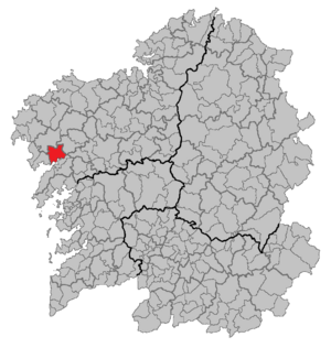
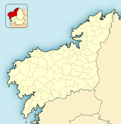
Location of Outes
|
||
| Country | ||
| Autonomous community | ||
| Province | A Coruña | |
| Area | ||
| • Total | 99.7 km2 (38.5 sq mi) | |
| Highest elevation | 531 m (1,742 ft) | |
| Lowest elevation | 0 m (0 ft) | |
| Population
(2018)
|
||
| • Total | 6,412 | |
| • Density | 64.31/km2 (166.57/sq mi) | |
| Demonym(s) | outiense | |
| Time zone | UTC+1 (CET) | |
| • Summer (DST) | UTC+2 (CEST) | |
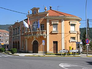
Outes is a small town, also called a municipality, located in the northwest part of Spain. It is found in the province of A Coruña, which is part of the autonomous community of Galicia. An autonomous community is like a large region in Spain that has its own government and rules.
Outes is home to about 6,155 people (based on the 2020 Spanish Census). The area it covers is about 100 square kilometers. This is roughly the size of 10,000 football fields!
Exploring Outes
Outes is known for its beautiful natural surroundings. It has five mountain peaks that are over 500 meters tall. The highest of these is called Monte Tremuzo. Imagine climbing to the top and seeing amazing views!
Local Life and Government
The people who live in Outes are called "outienses." The current leader of Outes is Carlos López Crespo. He is like the mayor, helping to manage the town and make decisions for its residents.
Interesting Facts
In 1994, a special event known as the Cando event took place within the area of Cando, which is a parish (a small local district) within Outes. This event involved a strange phenomenon that many people talked about.
Villages in Outes
Outes is made up of several smaller villages. One of these is:
- O Freixo de Sabardes
See Also
 In Spanish: Outes para niños


