Owenbrean River facts for kids
Quick facts for kids Owenbrean |
|
|---|---|
| Native name | Abhainn Bhréan |
| Country | United Kingdom |
| Region | Northern Ireland |
| County | Co. Fermanagh |
| Physical characteristics | |
| Main source | Eastern Cuilcagh Mountain |
| River mouth | River Cladagh Marble Arch Caves |
| Length | 8.5 km (5.3 mi) |
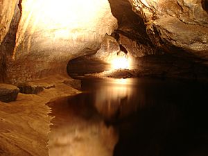
The Owenbrean River is a small but interesting river located in County Fermanagh, Northern Ireland. Its name, Abhainn Bhréan in Irish, means "stinking river," but don't let that fool you! This river starts high up on Cuilcagh Mountain and then disappears underground. It eventually flows into the amazing Marble Arch Caves system. Inside these caves, the Owenbrean River joins two other mountain rivers, the Sruh Croppa and the Aghinrawn. Together, these three rivers create the River Cladagh.
Contents
Journey of the Owenbrean River
The Owenbrean River collects water from the north-eastern side of Cuilcagh Mountain. It also gathers water from the southern and western slopes of Trien Mountain.
River's Path Above Ground
The river first flows north for about 5 km (3.1 mi). Then, it suddenly turns west and enters a narrow, enclosed valley called a "blind gorge." This gorge is about 300 m (980 ft) long. After the gorge, the river swings north again. It then reaches the impressive entrance of Pollasumera, which is surrounded by cliffs 20 m (66 ft) high. When the weather is dry, the river's water sinks into its bed within the gorge before it even reaches the cave entrance.
River's Path Underground
The Owenbrean River continues its journey underground through Pollasumera. It then goes through a "sump," which is a flooded passage, and reappears in another nearby cave called Pollnagollum of the Boats.
Eventually, the river enters the main Marble Arch Caves system. It flows through several sections of the cave, including Skreen Hill 3, Skreen Hill 2, and Skreen Hill 1. Skreen Hill 3 is a 650-metre (2,130 ft) long part of the cave that only divers can reach. Skreen Hill 1 is the deepest section of the show cave that visitors can see.
During a guided tour of the Marble Arch Caves, you can walk along a path next to the Owenbrean River. You even get to travel on the river for a short time during an underground boat trip! The Owenbrean River meets the combined Sruh Croppa and Aghinrawn rivers at a spot called The Junction. This meeting point is about halfway through the boat tour.
How the River Divides and Reconnects
Before the Owenbrean River reaches the main underground sinks in the blind gorge, some of its water takes a different path. This happens when parts of the river are redirected into what are known as the Upper and Lower Sinks.
These sinks feed into another cave system called Prod's Pot–Cascades Rising. The water from this system then comes back to the surface about 2.5 km (1.6 mi) away in Cladagh Glen. Here, this diverted water rejoins the original flow of the Owenbrean River, which by this point has already become the River Cladagh.
Understanding the River Names
The Marble Arch Caves system gets its water from three small rivers that flow down the northern side of Cuilcagh Mountain. From east to west, these rivers are the Owenbrean, the Aghinrawn, and the Sruh Croppa.
However, there has been some confusion about their names. The maps from the Ordnance Survey of Northern Ireland (OSNI) have mistakenly labeled the middle and eastern rivers. Locally, the river in the middle, which flows towards Monastir Cliff (and is called the Owenbrean on OSNI maps), has always been known as the Aghinrawn. The eastern river, which sinks at Pollasumera (and is not named on OSNI maps), is actually the Owenbrean. Most other books and information sources use these local names, which helps clear up the confusion.
 | John T. Biggers |
 | Thomas Blackshear |
 | Mark Bradford |
 | Beverly Buchanan |


