Oxbow, Oregon facts for kids
Quick facts for kids
Oxbow
|
|
|---|---|

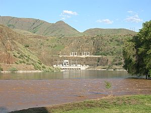
The Oxbow Dam
|
|
| Country | United States |
| State | Oregon |
| County | Baker |
| Elevation | 1,982 ft (604 m) |
| Time zone | UTC-7 (Mountain; de facto) UTC-8 Pacific (de jure) |
| • Summer (DST) | UTC-6 (MDT) |
| ZIP code |
97840
|
| Area codes | 541 and 458 |
| GNIS feature ID | 1167700 |
Oxbow is a small place in Baker County, Oregon, United States. It's called an "unincorporated community" because it doesn't have its own local government like a city does. Oxbow is located right next to the Snake River and the Oxbow Dam, close to the border between Oregon and Idaho. It's about 17 miles (27 km) northeast of a town called Halfway. Oxbow even has its own post office with the ZIP code 97840.
What's in a Name?
The name "Oxbow" comes from a special U-shaped bend in the Snake River. This kind of river bend is called an "oxbow" because it looks like the U-shaped wooden part of a harness used on an ox. Long ago, there was a train station named Oxbow in this area. It was part of the Oregon Short Line Railroad, but that part of the railway is now underwater because of the Oxbow Reservoir.
Building the Community
The current community of Oxbow started in the early 1960s. This was when the Idaho Power Company was building the Oxbow Dam. The dam project brought many workers to the area. The Oxbow post office opened on May 1, 1965. It moved from a place called Homestead, which was about six miles north. At one time, Oxbow even had its own school for the children living there.
Understanding the Climate
Oxbow has a type of weather known as a "warm-summer Mediterranean climate." This means the summers are warm and dry, but they don't get extremely hot. The average monthly temperatures in summer stay below 71.6 °F (22 °C). This climate type is often found in places with mild, wet winters and warm, dry summers.
 | Janet Taylor Pickett |
 | Synthia Saint James |
 | Howardena Pindell |
 | Faith Ringgold |


