Packard, Wisconsin facts for kids
Quick facts for kids
Packard, Wisconsin
|
|
|---|---|
| Country | |
| State | |
| County | Marinette |
| Elevation | 211 m (692 ft) |
| Time zone | UTC-6 (Central (CST)) |
| • Summer (DST) | UTC-5 (CDT) |
| Area code(s) | 715 & 534 |
| GNIS feature ID | 1577764 |
Packard is a small, quiet community in Marinette County, Wisconsin, United States. It's not a big city or town, but rather an "unincorporated community." This means it's a group of homes and buildings that aren't officially part of a city government. It's located in the larger area known as the town of Wagner.
Exploring Packard's Location
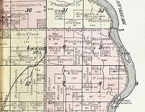
Packard is easy to find on a map! It sits right where two roads meet: Country Trunk Highway RR and Chapin Road. Imagine a crossroads, and that's where Packard is.
This community is about 692 feet (or 211 meters) above sea level. From Packard, you can travel by road to McAllister if you head south. If you go north, you'll reach Koss, Michigan.
Packard's Past: A Glimpse into History
Packard used to be an important stop along a railway line. This line was called the Wisconsin & Michigan (W. & M.) Railway. It connected Bagley Junction to Iron Mountain. Packard was located right between McAllister and Koss on this route.
However, the railway through Packard stopped running in 1938. The tracks were removed, and the trains and other equipment were sold. Before that, in October 1908, a big forest fire sadly destroyed the entire community of Packard.
 | Toni Morrison |
 | Barack Obama |
 | Martin Luther King Jr. |
 | Ralph Bunche |


