Palmer, Michigan facts for kids
Quick facts for kids
Palmer, Michigan
|
|
|---|---|

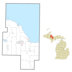
Location within Marquette County
|
|
| Country | United States |
| State | Michigan |
| County | Marquette |
| Township | Richmond |
| Area | |
| • Total | 0.59 sq mi (1.54 km2) |
| • Land | 0.59 sq mi (1.54 km2) |
| • Water | 0.00 sq mi (0.00 km2) |
| Elevation | 1,302 ft (397 m) |
| Population
(2020)
|
|
| • Total | 378 |
| • Density | 637.44/sq mi (246.16/km2) |
| Time zone | UTC-5 (Eastern (EST)) |
| • Summer (DST) | UTC-4 (EDT) |
| ZIP Code |
49871
|
| Area code(s) | 906 |
| FIPS code | 26-62180 |
| GNIS feature ID | 634306 |
Palmer is a small community in Marquette County, which is in the state of Michigan in the United States. It is called an "unincorporated community" because it doesn't have its own local government like a city or town. However, it is recognized as a "census-designated place" (CDP) for counting people and statistics.
In 2020, about 378 people lived in Palmer. It is located inside Richmond Township and can be reached by M-35, a state highway. The area covered by the Palmer ZIP Code (49871) is a bit larger than the CDP itself.
Contents
Geography of Palmer
Palmer is found in the middle part of Marquette County. It is about 10 miles (16 km) south of Negaunee by road. It is also about 15 miles (24 km) southwest of Marquette, which is the main city of the county.
Roads and Waterways
The community is served by M-35. This highway goes north to connect with US Highway 41 and M-28 between Negaunee and Marquette. If you go south on M-35 for about 16 miles (26 km), you will reach Gwinn.
The United States Census Bureau says that the Palmer CDP covers an area of 0.59 square miles (1.54 square kilometers). All of this area is land. Warner Creek flows through the community. This creek flows south and is a branch of the East Branch of the Escanaba River.
People Living in Palmer
The number of people living in Palmer has changed over the years. Here is how the population has been counted:
| Historical population | |||
|---|---|---|---|
| Census | Pop. | %± | |
| 2000 | 449 | — | |
| 2010 | 418 | −6.9% | |
| 2020 | 378 | −9.6% | |
| U.S. Decennial Census | |||
In 2000, there were 449 people living in Palmer. By 2020, the population had decreased to 378 people. The average age of people living in Palmer in 2000 was 44 years old.
Businesses and Economy
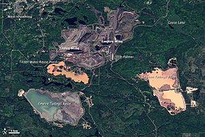
Palmer was once very close to the Empire Mine, which was owned by a company called Cleveland-Cliffs. This mine was a big part of the local economy. However, the mine stopped working in August 2016.
Past Local Businesses
Over the years, some local businesses have closed. Fran's gas station, which was the only gas station left, closed around late 2018. Trewhella's IGA grocery store, which started in 1961, also closed many years ago.
A radio station, WRUP/98.3, changed its official location from Munising to Palmer in 2009. This was done to help the station reach listeners in the larger city of Marquette.
Climate in Palmer
The weather in Palmer changes a lot throughout the year. It has what is called a humid continental climate. This means that summers can be warm to hot and often humid. Winters are typically very cold, and sometimes extremely cold. This type of climate is known as "Dfb" on climate maps.
See also
 In Spanish: Palmer (Míchigan) para niños


