Marquette County, Michigan facts for kids
Quick facts for kids
Marquette County
|
|
|---|---|
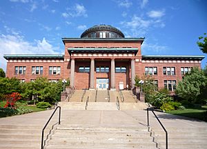
Marquette County Courthouse in Marquette
|
|
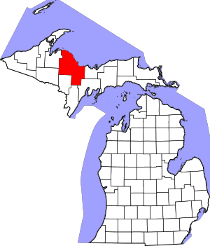
Location within the U.S. state of Michigan
|
|
 Michigan's location within the U.S. |
|
| Country | |
| State | |
| Founded | March 9, 1843, organized 1851 |
| Named for | Jacques Marquette |
| Seat | Marquette |
| Largest city | Marquette |
| Area | |
| • Total | 3,425 sq mi (8,870 km2) |
| • Land | 1,808 sq mi (4,680 km2) |
| • Water | 1,616 sq mi (4,190 km2) 47%% |
| Population
(2020)
|
|
| • Total | 66,017 |
| • Estimate
(2023)
|
66,999 |
| • Density | 37/sq mi (14/km2) |
| Time zone | UTC−5 (Eastern) |
| • Summer (DST) | UTC−4 (EDT) |
| Congressional district | 1st |
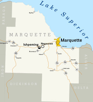
Marquette County is a county located in the Upper Peninsula of Michigan, a state in the United States. A county is like a smaller region within a state, often with its own local government. In 2020, about 66,017 people lived here, making it the most populated county in the Upper Peninsula. The main city and county seat (where the county government is) is Marquette. The county is named after Father Marquette, a famous Jesuit missionary. It was officially created in 1843 and started its government in 1851.
Marquette County is also part of the Marquette, MI micropolitan statistical area, which means it's an important center for jobs and life in the surrounding smaller towns.
Contents
Geography of Marquette County
Marquette County covers a large area. It has a total size of about 3,425 square miles. A big part of this, 1,808 square miles, is land, and 1,616 square miles (about 47%) is water. This makes it the largest county in Michigan by land area. It's also the fourth-largest by total area, including its many lakes and rivers.
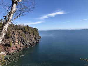
The Huron Mountains are a mountain range found in the county. To the north, the county borders Lake Superior, one of the largest freshwater lakes in the world.
Neighboring Counties
Marquette County shares borders with several other counties:
- Alger County, to the east
- Delta County, to the southeast
- Menominee County, to the south (near the Wisconsin border)
- Dickinson County, to the south (near the Wisconsin border)
- Iron County, to the southwest (near the Wisconsin border)
- Baraga County, to the west
- Houghton County, to the northwest
- Keweenaw County, to the north
Protected Natural Areas
Parts of these important natural areas are located in Marquette County:
Climate in Marquette County
Marquette County has a climate with cold, snowy winters and mild summers. It gets a lot of snow, especially because of its location near Lake Superior, which causes "lake-effect snow." Summers are generally pleasant, making it a nice place for outdoor activities.
Communities in Marquette County
Marquette County is home to several cities, towns, and smaller communities.
Cities in Marquette County
Charter Townships
- Chocolay Charter Township
- Marquette Charter Township
Civil Townships
- Champion Township
- Ely Township
- Ewing Township
- Forsyth Township
- Humboldt Township
- Ishpeming Township
- Michigamme Township
- Negaunee Township
- Powell Township
- Republic Township
- Richmond Township
- Sands Township
- Skandia Township
- Tilden Township
- Turin Township
- Wells Township
- West Branch Township
Census-Designated Places
These are areas that are like towns but are not officially incorporated as cities or villages.
- Big Bay
- Gwinn
- Harvey
- K.I. Sawyer
- Michigamme
- Palmer
- Republic
- Trowbridge Park
- West Ishpeming
Other Unincorporated Communities
These are smaller places that are not officially part of a city or census-designated place.
- Alder
- Antlers
- Arnold
- Beaver Grove
- Birch
- Brookton Corners
- Carlshend
- Clarksburg
- Dukes
- Eagle Mills
- Empire Iron Mine
- Gordon
- Green Garden
- Greenwood
- Homeier
- Huron Mountain
- Lakewood
- Lawson
- Little Lake
- Maple Grove
- McFarland
- Midway Location
- National Mine
- North Lake
- Northland
- Sand River
- Selma
- Snowville
- South Greenwood
- South Republic
- Suomi Location
- Vick
- Witch Lake
Indian Reservations
A small part of the L'Anse Indian Reservation is located in Chocolay Township. This reservation is mostly in Baraga County. Also, a very small piece of land belonging to the Sault Tribe of Chippewa Indians is within the city of Marquette.
Population History of Marquette County
| Historical population | |||
|---|---|---|---|
| Census | Pop. | %± | |
| 1850 | 136 | — | |
| 1860 | 2,821 | 1,974.3% | |
| 1870 | 15,033 | 432.9% | |
| 1880 | 25,394 | 68.9% | |
| 1890 | 39,521 | 55.6% | |
| 1900 | 41,239 | 4.3% | |
| 1910 | 46,739 | 13.3% | |
| 1920 | 45,786 | −2.0% | |
| 1930 | 44,076 | −3.7% | |
| 1940 | 47,144 | 7.0% | |
| 1950 | 47,654 | 1.1% | |
| 1960 | 56,154 | 17.8% | |
| 1970 | 64,686 | 15.2% | |
| 1980 | 74,101 | 14.6% | |
| 1990 | 70,887 | −4.3% | |
| 2000 | 64,634 | −8.8% | |
| 2010 | 67,077 | 3.8% | |
| 2020 | 66,017 | −1.6% | |
| 2023 (est.) | 66,999 | −0.1% | |
| US Decennial Census 1790-1960 1900-1990 1990-2000 2010-2018 |
|||
In 2020, the population of Marquette County was 66,017 people. The population has changed over the years, growing from just 136 people in 1850 to its current size.
Economy of Marquette County
Marquette County has a diverse economy with many different types of jobs. Some of the largest employers are in healthcare, mining, and education.
Major Employers
Here are some of the top employers in Marquette County, both private companies and public organizations:
|
| Public Employer | Number of Employees |
|---|---|
| Northern Michigan University | 914 |
| Marquette Area Public Schools | 410 |
| Michigan Department of Corrections | 350 |
| County of Marquette | 251 |
| Negaunee Public Schools | 190 |
| D.J. Jacobetti Home for Veterans | 167 |
| City of Marquette | 185 |
| NICE Community School District | 163 |
| Gwinn Area Community Schools | 140 |
| Ishpeming Public Schools | 104 |
- Bolded values were updated in 2021.
Education in Marquette County
Marquette County offers various educational opportunities, from public schools to a university.
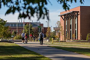
Northern Michigan University is a four-year university located in Marquette. It was founded in 1899 and provides many different study programs for students.
School Districts
Students in Marquette County attend schools in these districts:
- Gwinn Area Community Schools
- Ishpeming Public School District
- Marquette Area Public Schools
- Negaunee Public Schools
- NICE Community School District
- Powell Township Schools
- Republic-Michigamme School District
Historical Markers
Marquette County has several historical markers that tell stories about its past. These markers help people learn about important places and events in the county's history.
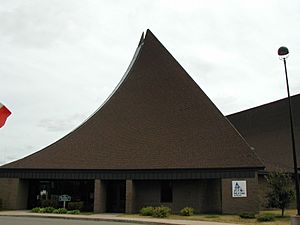
There are ten historical markers in the county, including:
- Cliffs Shaft Mine
- Dandelion Cottage
- Father Marquette Park
- First Steam Railroad in Upper Peninsula
- Ishpeming: Historic Ski Center
- Jackson Mine
- Marquette County Courthouse
- Marquette Iron Range
- Northern Michigan University
- Sam Cohodas Lodge / Sam Cohodas
Transportation in Marquette County
Getting around Marquette County is possible through various ways, including air travel, public buses, and a network of highways.
Airports
The main airport is Sawyer International Airport. It is owned by the county and is about 20 miles south of Marquette. This airport is on the site of the former K.I. Sawyer Air Force Base, which closed in 1995.
Public Transit
- MarqTran provides local bus services within Marquette and nearby areas.
- Indian Trails offers bus services that connect Marquette County to other cities.
Major Highways
A network of state highways runs through Marquette County, making it easy to travel by car.
Key highways include:
 US 41
US 41 M-28
M-28 M-35
M-35 M-94
M-94 M-95
M-95 M-553
M-553
The Marquette County Road Commission also takes care of many county roads. They even help with snow removal on state highways during winter.
See also
 In Spanish: Condado de Marquette (Míchigan) para niños
 | Janet Taylor Pickett |
 | Synthia Saint James |
 | Howardena Pindell |
 | Faith Ringgold |


