Alger County, Michigan facts for kids
Quick facts for kids
Alger County
|
|||
|---|---|---|---|
|
|||
|
|||
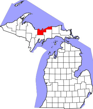
Location within the U.S. state of Michigan
|
|||
 Michigan's location within the U.S. |
|||
| Country | |||
| State | |||
| Founded | March 17, 1885 | ||
| Named for | Russell A. Alger | ||
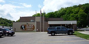
| Seat | Munising | ||
| Largest city | Munising | ||
| Area | |||
| • Total | 5,048 sq mi (13,070 km2) | ||
| • Land | 915 sq mi (2,370 km2) | ||
| • Water | 4,133 sq mi (10,700 km2) 82%% | ||
| Population
(2020)
|
|||
| • Total | 8,842 | ||
| • Density | 10/sq mi (4/km2) | ||
| Time zone | UTC−5 (Eastern) | ||
| • Summer (DST) | UTC−4 (EDT) | ||
| Congressional district | 1st | ||
| Website | https://www.algercounty.gov/ | ||
Alger County is a county located in the Upper Peninsula of the U.S. state of Michigan. As of the 2020 Census, about 8,842 people live there. It is the second-largest county in Michigan by its total area. This is because a large part of its area includes the waters of Lake Superior. The main town and county seat is Munising.
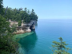
Alger County is home to Pictured Rocks National Lakeshore. Here you can see amazing rock formations, beautiful waterfalls, and sandy sand dunes along the shore of Lake Superior. A big part of the county is also within the Hiawatha National Forest. This forest is great for outdoor adventures.
Contents
History of Alger County
Alger County was created from Schoolcraft County in 1885. It was officially set up and organized in that year.
The county was named after Russell Alexander Alger. He was a very successful businessman in the lumber industry. Later, he became the Governor of Michigan, a US Senator, and even the US Secretary of War. He served during the time William McKinley was President.
Geography and Nature
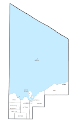
Alger County covers a total area of about 5,048 square miles. Out of this, 915 square miles is land. The remaining 4,133 square miles, which is about 82% of the county, is water. This makes it the second-largest county in Michigan by total area. Most of the water area comes from Lake Superior on the north side of the county.
Main Roads
Some of the important roads that pass through Alger County include:
- US 41
- M-28
- M-94
- H-58, which goes through Pictured Rocks National Lakeshore.
Neighboring Areas
Alger County shares borders with other counties.
By Land
- Luce County to the east
- Schoolcraft County to the southeast
- Delta County to the south
- Marquette County to the west
By Water
- Thunder Bay District, Ontario in Canada to the north, across Lake Superior.
Protected Natural Places
Alger County is home to several important natural areas. These places are protected to keep them beautiful and healthy.
- Grand Island National Recreation Area
- Part of the Hiawatha National Forest
- Pictured Rocks National Lakeshore
Population and People
| Historical population | |||
|---|---|---|---|
| Census | Pop. | %± | |
| 1890 | 1,238 | — | |
| 1900 | 5,868 | 374.0% | |
| 1910 | 7,675 | 30.8% | |
| 1920 | 9,983 | 30.1% | |
| 1930 | 9,327 | −6.6% | |
| 1940 | 10,167 | 9.0% | |
| 1950 | 10,007 | −1.6% | |
| 1960 | 9,250 | −7.6% | |
| 1970 | 8,568 | −7.4% | |
| 1980 | 9,225 | 7.7% | |
| 1990 | 8,972 | −2.7% | |
| 2000 | 9,862 | 9.9% | |
| 2010 | 9,601 | −2.6% | |
| 2020 | 8,842 | −7.9% | |
| 2023 (est.) | 8,757 | −8.8% | |
| US Decennial Census 1790-1960 1900-1990 1990-2000 2010-2018 |
|||
The 2010 United States census showed that Alger County had a population of 9,601 people. In 2020, the population was 8,842.
In 2010, about 17.1% of the people living in Alger County were under 18 years old. The median age was 47.3 years. This means half the people were older than 47.3 and half were younger.
Communities in Alger County
Alger County has different types of communities.
City
- Munising is the largest city and the county seat.
Village
- Chatham is a smaller village.
Townships
Townships are local government areas. Alger County has several:
- Au Train Township
- Burt Township
- Grand Island Township
- Limestone Township
- Mathias Township
- Munising Township
- Onota Township
- Rock River Township
Census-Designated Place
- Grand Marais is a community that is counted for census purposes but is not an official city or village.
Other Communities
There are many smaller, unincorporated communities in Alger County. These are places where people live but they don't have their own local government like a city or village. Some examples include:
- Au Train
- Christmas
- Deerton
- Eben Junction
- Forest Lake
- Grand Marais
- Limestone
- Melstrand
- Shingleton
- Trenary
- Wetmore
Indian Reservations
Alger County includes two very small parts of the Sault Tribe of Chippewa Indians tribal community. The main office for this tribe is in Sault Ste. Marie. One small part is in the northeastern corner of Au Train Township. Another slightly larger part is about two miles south of Munising in Munising Township.
See also
 In Spanish: Condado de Alger para niños
 | Victor J. Glover |
 | Yvonne Cagle |
 | Jeanette Epps |
 | Bernard A. Harris Jr. |


