Houghton County, Michigan facts for kids
Quick facts for kids
Houghton County
|
||
|---|---|---|
|
||
|
||
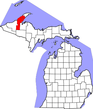
Location within the U.S. state of Michigan
|
||
 Michigan's location within the U.S. |
||
| Country | ||
| State | ||
| Founded | 1843 (set off) 1845 (boundaries described) 1846 (organized) 1848 (re-organized) |
|
| Named for | Douglass Houghton | |
| Seat | Houghton | |
| Largest city | Houghton | |
| Area | ||
| • Total | 1,502 sq mi (3,890 km2) | |
| • Land | 1,009 sq mi (2,610 km2) | |
| • Water | 492 sq mi (1,270 km2) 33%% | |
| Population
(2020)
|
||
| • Total | 37,361 | |
| • Density | 36/sq mi (14/km2) | |
| Time zone | UTC−5 (Eastern) | |
| • Summer (DST) | UTC−4 (EDT) | |
| Congressional district | 1st | |
Houghton County is a county located in the Upper Peninsula of Michigan, a state in the United States. In 2020, about 37,361 people lived here. The main city and county seat is Houghton. Both the county and the city are named after Douglass Houghton. He was Michigan's first State Geologist and also served as the mayor of Detroit.
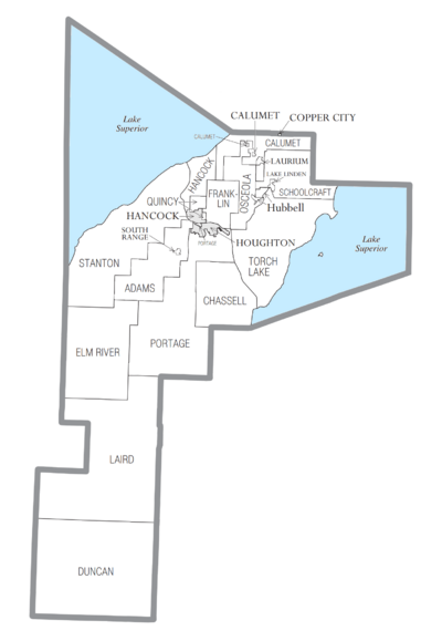
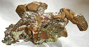
Houghton County is part of the Houghton Micropolitan Statistical Area. This area also includes Keweenaw County. Long ago, during the late 1800s and early 1900s, this region was known as the Copper Country. This was a time when copper mining was a very big industry here.
Contents
History of Houghton County
In 1843, the Upper Peninsula was divided into several counties. Houghton County's borders were officially set in 1845. Parts of Marquette and Ontonagon Counties were used to create it. The county was named after Douglass Houghton. He was the first State Geologist for Michigan. He explored the Upper Peninsula a lot, looking for minerals.
The original Houghton County was much larger. It included the areas that are now Keweenaw and Baraga Counties. In 1846, the county was organized into three townships: Eagle Harbor, Houghton, and L'Anse. Later, Keweenaw County became its own county in 1861. Baraga County also separated from Houghton County in 1875.
Immigration and Culture
Houghton County's history is strongly shaped by people moving there from other countries. Around 1910, a large part of the population (over 40%) was born in other countries. Many more had parents who were born elsewhere. This mix of people from many different countries created a special culture. A large number of these immigrants were from Finland. In 1910, about 13% of the people living there were born in Finland. Today, about 32% of the population still has Finnish ancestors. This shows how important Finnish culture is to the area.
Changes Over Time
During the Great Depression in the 1930s, many people lost their jobs in mining and timber. So, the county started growing potatoes instead. For a short time in the 1930s and 1940s, Houghton County became a major place for growing and selling potatoes in the United States.
In June 2018, a big flash flood hit the area. It caused sinkholes and washouts in towns like Chassell, Houghton, Lake Linden, and Hubbell.
Geography and Landmarks
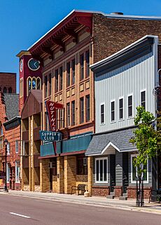
Houghton County covers about 1,502 square miles. About 1,009 square miles are land, and 492 square miles are water. This means about 33% of the county is covered by water.
The Portage Lift Bridge is a very important landmark. It crosses Portage Lake, connecting the cities of Hancock and Houghton, Michigan. This bridge is part of the Portage Lake river and canal system. It is known as the world's heaviest and widest double-decked vertical lift bridge. The middle part of the bridge can lift up to let ships pass underneath. In winter, the lower deck is used by snowmobiles. This bridge is the only land connection between the northern and southern parts of the Keweenaw Peninsula. This makes it very important for local travel.
Major Roads
 US 41 runs through the county. It goes from the southeast, through Chassell and Houghton, then northeast to Copper Harbor.
 M-26 enters from the west. It goes northeast through South Range and Houghton.
 M-28 runs east to west across the lower part of the county.
 M-38 runs east to west across the middle of the county.
 M-203 goes northwest from Houghton, then loops northeast.
Airports
- Prickett-Grooms Field (6Y9) is a smaller, privately owned airport in Sidnaw.
- Houghton County Memorial Airport (KCMX) is located between Hancock and Calumet. It offers general aviation and some commercial flights.
Neighboring Counties
- Keweenaw County to the north.
- Baraga County to the east.
- Iron County to the south.
- Ontonagon County to the west.
Protected Natural Areas
- Part of Keweenaw National Historical Park.
- Part of Ottawa National Forest.
Climate
|
||||||||||||||||||||||||||||||||||||||||||||||||||||||||||||||||||||||||||||||||||||||||||||||||
Houghton County experiences cold winters and mild summers. The climate chart above shows the average temperatures and rainfall for the area throughout the year.
Communities in Houghton County
Cities
Villages
Charter Townships
Civil Townships
- Adams Township
- Chassell Township
- Duncan Township
- Elm River Township
- Franklin Township
- Hancock Township
- Laird Township
- Osceola Township
- Quincy Township
- Schoolcraft Township
- Stanton Township
- Torch Lake Township
Census-Designated Places
These are areas that are like towns but are not officially incorporated as cities or villages.
- Atlantic Mine
- Chassell
- Dodgeville
- Dollar Bay
- Hubbell
- Hurontown
- Painesdale
- Trimountain
Other Unincorporated Communities
These are smaller communities that are not officially part of a city, village, or census-designated place.
- Alston
- Askel
- Baltic
- Beacon Hill
- Blue Jacket
- Bootjack
- Boston
- Centennial
- Centennial Heights
- Champion Mine
- Chickenville
- Dakota Heights
- Donken
- Dreamland
- Elo
- Florida
- Franklin Mine
- Freda
- Frost
- Gregoryville
- Kearsarge
- Kenton
- Klingville
- Lake Roland
- Liminga
- Mason
- Nisula
- Oneco
- Osceola
- Oskar
- Paavola
- Pewabic
- Phillipsville
- Pilgrim
- Point Mills
- Pori
- Portage Entry
- Rabbit Bay
- Redridge
- Ripley
- Schmidt Corner
- Seeberville
- Senter
- Sidnaw
- Superior
- Swedetown
- Tamarack City
- Tapiola
- Toivola
- Traverse Bay
- Twin Lakes
- Winona
- Wolverine
- Yellow Jacket
Ghost Towns
These are places where people used to live, but now they are mostly empty or abandoned.
- Albion Station
- Backstreet
- Bishop
- Boot Jack Point
- Craig Roy
- E-Location
- Elm River
- Frenchtown
- Jacobsville
- Motley
- White City
- Wyandotte
Population and People
| Historical population | |||
|---|---|---|---|
| Census | Pop. | %± | |
| 1850 | 708 | — | |
| 1860 | 9,234 | 1,204.2% | |
| 1870 | 13,879 | 50.3% | |
| 1880 | 22,473 | 61.9% | |
| 1890 | 35,389 | 57.5% | |
| 1900 | 66,063 | 86.7% | |
| 1910 | 88,098 | 33.4% | |
| 1920 | 71,930 | −18.4% | |
| 1930 | 52,851 | −26.5% | |
| 1940 | 47,631 | −9.9% | |
| 1950 | 39,771 | −16.5% | |
| 1960 | 35,654 | −10.4% | |
| 1970 | 34,652 | −2.8% | |
| 1980 | 37,872 | 9.3% | |
| 1990 | 35,446 | −6.4% | |
| 2000 | 36,016 | 1.6% | |
| 2010 | 36,628 | 1.7% | |
| 2020 | 37,361 | 2.0% | |
| 2023 (est.) | 37,599 | 2.7% | |
| US Decennial Census 1790-1960 1900-1990 1990-2000 2010-2018 |
|||
The population of Houghton County has changed a lot over the years. It grew very quickly during the mining boom in the late 1800s and early 1900s. The highest population was in 1910, with over 88,000 people. Since then, the population has decreased and then stayed fairly steady. In 2020, there were 37,361 people living in the county.
Who Lives Here?
According to the 2020 census, most people in Houghton County are White (about 93.9%). There are also smaller groups of Asian (2.5%), Black or African American (1.1%), and Native American (0.8%) residents. About 1.9% of the population is of Hispanic or Latino background.
In 2010, the largest ancestry group was Finnish, making up about 32.5% of the population. Other large ancestry groups included German (14%), French (9.4%), English (6.2%), and Irish (5.1%). This shows the diverse backgrounds of the people who call Houghton County home.
The average age in the county in 2010 was about 33.1 years old. This is a bit younger than many other places, partly because of the colleges and universities in the area.
Images for kids
-
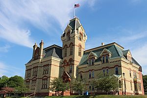
The Finlandia University in Hancock
See also
 In Spanish: Condado de Houghton para niños
 | Aurelia Browder |
 | Nannie Helen Burroughs |
 | Michelle Alexander |


