South Range, Michigan facts for kids
Quick facts for kids
South Range, Michigan
|
|
|---|---|
|
Village
|
|

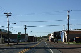
Looking south along M-26
|
|

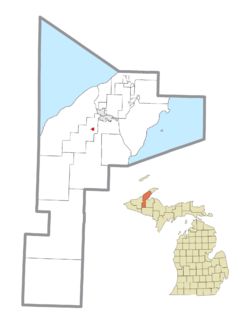
Location within Houghton County
|
|
| Country | United States |
| State | Michigan |
| County | Houghton |
| Township | Adams |
| Platted | 1902 |
| Government | |
| • Type | Village council |
| Area | |
| • Total | 0.36 sq mi (0.94 km2) |
| • Land | 0.36 sq mi (0.94 km2) |
| • Water | 0.00 sq mi (0.00 km2) |
| Elevation | 1,139 ft (347 m) |
| Population
(2020)
|
|
| • Total | 750 |
| • Density | 2,060.44/sq mi (795.09/km2) |
| Time zone | UTC-5 (Eastern (EST)) |
| • Summer (DST) | UTC-4 (EDT) |
| ZIP code(s) |
49963
|
| Area code(s) | 906 |
| FIPS code | 26-75220 |
| GNIS feature ID | 0638402 |
South Range is a small village located in Houghton County, Michigan. It is part of Adams Township. The village is found about five miles southwest of Houghton. It sits along M-26, a state highway.
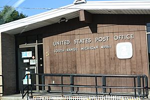
To its east, South Range borders the community of Baltic. In 2010, about 758 people lived in the village. The postal code for South Range is 49963. South Range is also a partner community of the Keweenaw National Historical Park.
Contents
History of South Range
South Range was first planned out in 1902. This was done by the Wheal Kate Mining Company. They had a copper mine nearby, but it was not very successful.
In 1906, the community tried to become an official town. They wanted to name it Stanton. However, there was already a town called Stanton in Michigan. So, they chose the name South Range instead. This name was picked because the village is at the southern end of Michigan's copper range. Many people from Italy were among the first residents of the village.
Events During the Copper Strike
On December 11, 1913, an important event happened during the Copper Country Strike. This strike was a difficult time for workers in the copper mines. A group called the Citizens' Alliance carried out a search in South Range. This happened just a few days after a tragic event in Painesdale, Michigan.
During the search, 37 rifles and hundreds of bullets were found and taken away. Twenty-three striking workers were arrested. A deputy named T. Driscoll was also shot in the arm, but his injury was not life-threatening.
Geography of the Village
South Range is a small village with a total area of about 0.36 square miles (0.94 square kilometers). All of this area is land. There are no large bodies of water within the village limits.
Population and People
| Historical population | |||
|---|---|---|---|
| Census | Pop. | %± | |
| 1910 | 1,097 | — | |
| 1920 | 1,435 | 30.8% | |
| 1930 | 1,120 | −22.0% | |
| 1940 | 918 | −18.0% | |
| 1950 | 712 | −22.4% | |
| 1960 | 760 | 6.7% | |
| 1970 | 898 | 18.2% | |
| 1980 | 861 | −4.1% | |
| 1990 | 745 | −13.5% | |
| 2000 | 727 | −2.4% | |
| 2010 | 758 | 4.3% | |
| 2020 | 750 | −1.1% | |
| U.S. Decennial Census | |||
2010 Census Information
Based on the census from 2010, 758 people lived in South Range. There were 343 households and 181 families in the village. The population density was about 2,105 people per square mile.
Most of the people living in the village were White (95.9%). A smaller number were Native American (0.4%), Asian (1.2%), or from two or more races (2.4%). About 1.1% of the population was Hispanic or Latino.
In terms of households, 23% had children under 18 living there. About 38.5% were married couples. Many households (47.2%) were not families. Also, 39.7% of all households had only one person living there. About 16.6% of households had someone 65 years or older living alone.
The average age in the village was 40.2 years. About 23.4% of residents were under 18. Another 19.7% were 65 years or older. The village had slightly more males (52%) than females (48%).
See also
 In Spanish: South Range (Míchigan) para niños
 | Jackie Robinson |
 | Jack Johnson |
 | Althea Gibson |
 | Arthur Ashe |
 | Muhammad Ali |


