Paracuellos de Jarama facts for kids
Quick facts for kids
Paracuellos del Jarama
|
|||
|---|---|---|---|

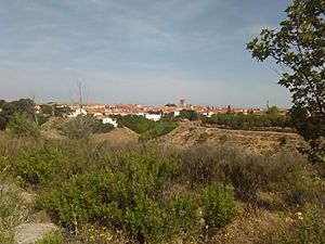
View of Paracuellos from the South
|
|||
|
|||
| Country | |||
| Autonomous community | Community of Madrid | ||
| Comarca | Madrid metropolitan area | ||
| Area | |||
| • Total | 16.96 sq mi (43.92 km2) | ||
| Elevation | 2,152 ft (656 m) | ||
| Population
(2018)
|
|||
| • Total | 24,521 | ||
| • Density | 1,446.02/sq mi (558.31/km2) | ||
| Time zone | UTC+1 (CET) | ||
| • Summer (DST) | UTC+2 (CEST) | ||
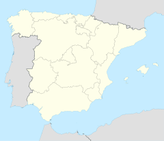
Paracuellos del Jarama is a town and municipality in the Community of Madrid, Spain. It is located northeast of the big city of Madrid. The town is also very close to Madrid-Barajas Airport. The meaning of its name is not fully clear.
Getting Around Paracuellos
Paracuellos del Jarama has a good public transport system. This helps people move around the town and travel to nearby cities.
Town Bus Routes
These bus lines help people travel within Paracuellos del Jarama itself.
- Line 1: Connects the Altos de Jarama area with Miramadrid.
- Line 2: Travels between Picón del Cura and the Los Berrocales area.
- Line 3: Goes from the Industrial Estate to the San Fernando Shopping Center.
Buses to Other Cities
These bus lines connect Paracuellos del Jarama to other towns and to Madrid.
- 210: Travels between San Sebastián de los Reyes (Infanta Sofía Hospital) and Paracuellos del Jarama.
- 211: Connects Madrid (Canillejas area) with Paracuellos del Jarama.
- 212: Also goes from Madrid (Canillejas) to Paracuellos del Jarama, specifically to the Miramadrid area.
- 213: Links Madrid (Canillejas) to Belvis.
- 215: Travels between Torrejón de Ardoz and Paracuellos del Jarama.
- 256: Connects Madrid (Canillejas) with Daganzo de Arriba and Valdeavero.
- 263: Goes from Madrid (Barajas) to Cobeña and Algete.
See Also
 In Spanish: Paracuellos de Jarama for kids
Black History Month on Kiddle
Influential African-American Artists:
 | James Van Der Zee |
 | Alma Thomas |
 | Ellis Wilson |
 | Margaret Taylor-Burroughs |

All content from Kiddle encyclopedia articles (including the article images and facts) can be freely used under Attribution-ShareAlike license, unless stated otherwise. Cite this article:
Paracuellos de Jarama Facts for Kids. Kiddle Encyclopedia.


