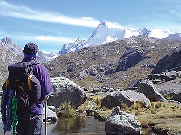
Pariacaca mountain range facts for kids
Quick facts for kids Pariacaca mountain range |
|
|---|---|
| Huarochirí mountain range | |

Pariacaca, south peak
|
|
| Highest point | |
| Peak | Pariacaca |
| Elevation | 5,750 m (18,860 ft) |
| Geography | |
| Country | Peru |
| State/Province | Junín Region, Lima Region |
| Parent range | Andes |
The Pariacaca mountain range is a group of tall mountains in the Andes of Peru. It is also known as the Huarochirí mountain range. The name "Pariacaca" might come from the Quechua language. It could mean "reddish rock" or "sparrow rock." Pariacaca was also the name of an important mountain god (apu) in ancient Inca beliefs.
This mountain range is found in two regions of Peru: the Junín Region (in the Jauja and Yauli provinces) and the Lima Region (in the Huarochirí and Yauyos provinces). It is a part of the central mountain chain of Peru, called the Cordillera Central.
Tallest Mountains
The highest mountain in this range is Pariacaca itself. It stands very tall at 5,750 meters (about 18,865 feet) above sea level. Many other impressive peaks are also part of the Pariacaca mountain range.
- Tunshu, 5,660 m (18,570 ft)
- Colquepucro, 5,658 m (18,563 ft)
- Carhuachuco, 5,507 m (18,068 ft)
- Paka, 5,500 m (18,045 ft)
- Suyruqucha, 5,500 m (18,045 ft)
- Huallacancha, 5,500 m (18,045 ft)
- Antachaire, 5,400 m (17,717 ft)
- Nina Ukru, 5,400 m (17,717 ft)
- Pachanqutu, 5,400 m (17,717 ft)
- Paqcha, 5,400 m (17,717 ft)
- Wayllakancha, 5,400 m (17,717 ft)
- Kunkus Yantaq, 5,354 m (17,566 ft)
- Wararayuq, 5,354 m (17,566 ft)
- Tuku Mach'ay, 5,350 m (17,552 ft)
- Putka, 5,300 m (17,388 ft)
- Qayqu, 5,300 m (17,388 ft)
- Tata Qayqu, 5,300 m (17,388 ft)
- Yantayuq, 5,300 m (17,388 ft)
- Chumpi, 5,250 m (17,224 ft)
- Ch'uspi, 5,200 m (17,060 ft)
- Quriwasi, 5,200 m (17,060 ft)
- Uqhu, 5,200 m (17,060 ft)
- Ukhu Qhata, 5,200 m (17,060 ft)
- Wiqu, 5,200 m (17,060 ft)
- Wamanripa, 5,110 m (16,765 ft)
- Kiwyu Waqanan, 5,100 m (16,732 ft)
- Qayqu, 5,100 m (16,732 ft)
- Chhuqu P'ukru, 5,000 m (16,404 ft)
- Parya Chaka, 5,000 m (16,404 ft)
- Kunkus, 5,000 m (16,404 ft)
- Kunkus (Yauli), 5,000 m (16,404 ft)
- Suyuq, 5,000 m (16,404 ft)
- Turiyuq, 5,000 m (16,404 ft)
- Uqsha Wallqa, 5,000 m (16,404 ft)
- Wallapi, 4,800 m (15,748 ft)
See also
 In Spanish: Cordillera Pariacaca para niños
 | Roy Wilkins |
 | John Lewis |
 | Linda Carol Brown |

